Approximate Location Map
Large Map »
Latitude: 56.2125 / 56°12'45"N
Longitude: -2.9411 / 2°56'28"W
OS Eastings: 341722
OS Northings: 702615
OS Grid: NO417026
Mapcode National: GBR 2K.DK6J
Mapcode Global: WH7SP.S3MQ
Plus Code: 9C8V6375+2G
Entry Name: Bridgend House And Outbuildings, 2 Harbour Wynd, Lower Largo
Listing Name: Lower Largo Bridgend House and out Buildings
Listing Date: 1 March 1984
Category: C
Source: Historic Scotland
Source ID: 341167
Historic Scotland Designation Reference: LB8936
Building Class: Cultural
ID on this website: 200341167
Location: Largo
County: Fife
Electoral Ward: Leven, Kennoway and Largo
Parish: Largo
Traditional County: Fife
Tagged with: Architectural structure
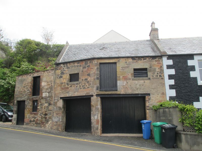
Earlier 19th century. 2 storeys and dormerless attic, 3 bays; painted whin rubble with contrasting long and short roughly droved dressings. Central door with later timber porch; modern glazing; end stacks, slate roof. 2 storey range of outbuildings, stables, lofts etc, rubble built to north.
External links are from the relevant listing authority and, where applicable, Wikidata. Wikidata IDs may be related buildings as well as this specific building. If you want to add or update a link, you will need to do so by editing the Wikidata entry.


Other nearby listed buildings
