Approximate Location Map
Large Map »
Latitude: 56.184 / 56°11'2"N
Longitude: -2.8127 / 2°48'45"W
OS Eastings: 349653
OS Northings: 699334
OS Grid: NT496993
Mapcode National: GBR 2Q.GB23
Mapcode Global: WH7SR.RTTN
Plus Code: 9C8V55MP+HW
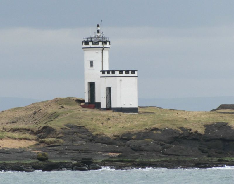
Entry Name: Lighthouse, Elie Ness
Listing Name: Elie Ness Lighthouse
Listing Date: 25 November 1980
Category: C
Source: Historic Scotland
Source ID: 341244
Historic Scotland Designation Reference: LB8997
Building Class: Cultural
ID on this website: 200341244
Location: Elie
County: Fife
Electoral Ward: East Neuk and Landward
Parish: Elie
Traditional County: Fife
Tagged with: Lighthouse
Early 20th century. 2 storey. Circular tower with corbelled, crenellated parapet; small single storey square tower also with crenellated parapet stands to North West side, harled with exposed dressings.
Landmark.
External links are from the relevant listing authority and, where applicable, Wikidata. Wikidata IDs may be related buildings as well as this specific building. If you want to add or update a link, you will need to do so by editing the Wikidata entry.


Other nearby listed buildings
