Approximate Location Map
Large Map »
Latitude: 57.4815 / 57°28'53"N
Longitude: -2.7093 / 2°42'33"W
OS Eastings: 357565
OS Northings: 843689
OS Grid: NJ575436
Mapcode National: GBR M8NY.KK6
Mapcode Global: WH7LM.C62Z
Plus Code: 9C9VF7JR+H7
Entry Name: Cobairdy
Listing Name: Cobairdy House
Listing Date: 16 April 1971
Category: B
Source: Historic Scotland
Source ID: 341724
Historic Scotland Designation Reference: LB9453
Building Class: Cultural
ID on this website: 200341724
Location: Forgue
County: Aberdeenshire
Electoral Ward: Huntly, Strathbogie and Howe of Alford
Parish: Forgue
Traditional County: Aberdeenshire
Tagged with: Building
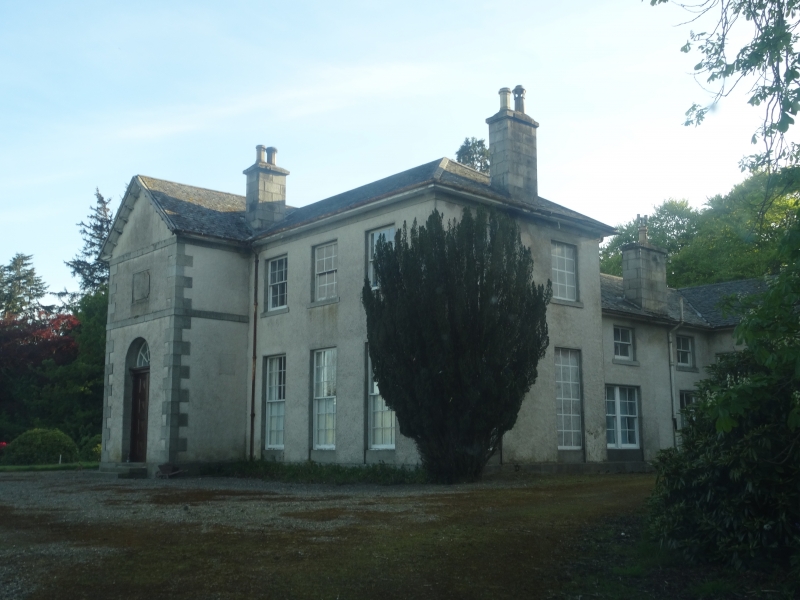
Circa 1855/60 (?). Late Georgian Italianate survival.
2-storey harled with margins, piend roof: 6-window S.
front, centre 2 projected with pediment and semi-circular
centre ground floor bay: asymmetrical E. elevation. 2-storey
quoined and pedimented porch with broad eaved gable, arched
doorpiece with fanlight.
A larger and rather earlier looking edition, of
Knockleith in Auchterless Parish which dates from 1864.
External links are from the relevant listing authority and, where applicable, Wikidata. Wikidata IDs may be related buildings as well as this specific building. If you want to add or update a link, you will need to do so by editing the Wikidata entry.


