Approximate Location Map
Large Map »
Latitude: 54.9828 / 54°58'57"N
Longitude: -3.773 / 3°46'22"W
OS Eastings: 286636
OS Northings: 566790
OS Grid: NX866667
Mapcode National: GBR 2B2T.YM
Mapcode Global: WH5X1.00MY
Plus Code: 9C6RX6MG+4R
Entry Name: Kirkgunzeon Churchyard
Listing Name: Kirkgunzeon Parish Church Graveyard, Mcwhire Monument
Listing Date: 23 April 1990
Category: B
Source: Historic Scotland
Source ID: 341973
Historic Scotland Designation Reference: LB9678
Building Class: Cultural
ID on this website: 200341973
Location: Kirkgunzeon
County: Dumfries and Galloway
Electoral Ward: Castle Douglas and Crocketford
Parish: Kirkgunzeon
Traditional County: Kirkcudbrightshire
Tagged with: Churchyard
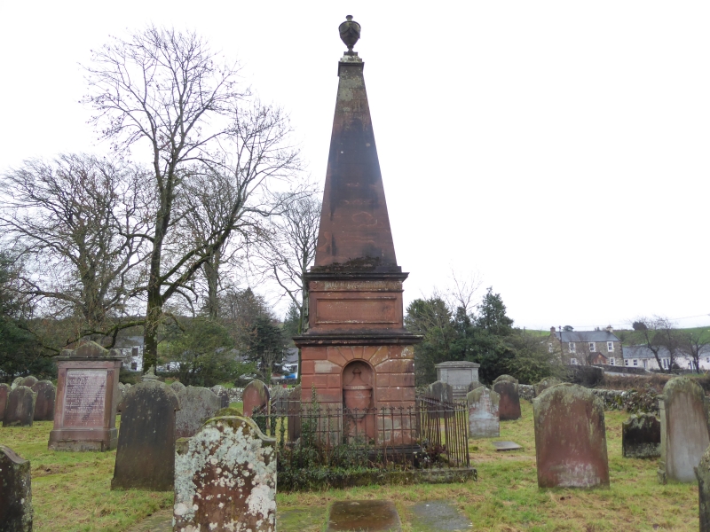
Circa 1831. Tall sandstone monument to the McWhire family
sited in Kirkgunzeon parish church graveyard. Monument in 3
stages; rusticated lower stage with urn in niche supports
podium with dedicatory inscription. Above rises tall
sandstone obelisk with urn finial.
B group with Kirkgunzeon Parish Church and Mansepark.
External links are from the relevant listing authority and, where applicable, Wikidata. Wikidata IDs may be related buildings as well as this specific building. If you want to add or update a link, you will need to do so by editing the Wikidata entry.


Other nearby listed buildings
