Approximate Location Map
Large Map »
Latitude: 55.1874 / 55°11'14"N
Longitude: -3.8935 / 3°53'36"W
OS Eastings: 279545
OS Northings: 589755
OS Grid: NX795897
Mapcode National: GBR 187G.W8
Mapcode Global: WH4TP.5W75
Plus Code: 9C7R54P4+WJ
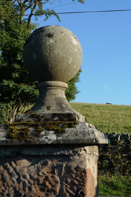
Entry Name: Gate Piers, Lower Ingleston
Listing Name: Lower Ingleston Gatepiers
Listing Date: 26 June 1986
Category: B
Source: Historic Scotland
Source ID: 342757
Historic Scotland Designation Reference: LB10323
Building Class: Cultural
ID on this website: 200342757
Location: Glencairn
County: Dumfries and Galloway
Electoral Ward: Mid and Upper Nithsdale
Parish: Glencairn
Traditional County: Dumfriesshire
Tagged with: Architectural structure
Dated 1801. 2 rubble-built square gatepiers corniced, with
ball finials, that to north inscribed "T & M Smith" and
dated.
External links are from the relevant listing authority and, where applicable, Wikidata. Wikidata IDs may be related buildings as well as this specific building. If you want to add or update a link, you will need to do so by editing the Wikidata entry.


Other nearby listed buildings
