Latitude: 56.9002 / 56°54'0"N
Longitude: -2.4509 / 2°27'3"W
OS Eastings: 372632
OS Northings: 778847
OS Grid: NO726788
Mapcode National: GBR X5.WWXW
Mapcode Global: WH8QL.BT4M
Plus Code: 9C8VWG2X+3J
Entry Name: Ingleside, High Street, Auchenblae
Listing Name: Ingleside High Street Auchenblae
Listing Date: 25 November 1980
Category: C
Source: Historic Scotland
Source ID: 343241
Historic Scotland Designation Reference: LB10755
Building Class: Cultural
ID on this website: 200343241
Location: Fordoun
County: Aberdeenshire
Electoral Ward: Mearns
Parish: Fordoun
Traditional County: Kincardineshire
Tagged with: House
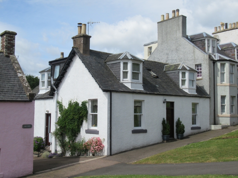
Earlier 19th century. Single storey and attic, harled with margins. Central door with reglazed fanlight, two windows and two later canted dormers. 12 pane sashes at ground floor, 4 at dormers. Rear wing with door, canted dormer and two windows in west gable. Slated roof, no skews, original end stack.
External links are from the relevant listing authority and, where applicable, Wikidata. Wikidata IDs may be related buildings as well as this specific building. If you want to add or update a link, you will need to do so by editing the Wikidata entry.


Other nearby listed buildings