Approximate Location Map
Large Map »
Latitude: 56.6074 / 56°36'26"N
Longitude: -2.8158 / 2°48'56"W
OS Eastings: 350018
OS Northings: 746465
OS Grid: NO500464
Mapcode National: GBR VP.1PYG
Mapcode Global: WH7QT.Q6B1
Plus Code: 9C8VJ54M+XM
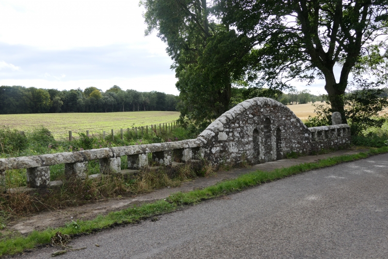
Entry Name: Boley Bridge
Listing Name: "Boley Bridge" over Greenmire Burn.
Listing Date: 11 June 1971
Category: B
Source: Historic Scotland
Source ID: 343985
Historic Scotland Designation Reference: LB11397
Building Class: Cultural
ID on this website: 200343985
Location: Forfar
County: Angus
Electoral Ward: Arbroath West, Letham and Friockheim
Parish: Forfar
Traditional County: Angus
Tagged with: Bridge
Small single semi-circular arch, rubble with cut-water and
flanking storm water arch. Parapets pierced with rectangular
boles and centre arches contain three-light gothic apertures.
18th cent.
External links are from the relevant listing authority and, where applicable, Wikidata. Wikidata IDs may be related buildings as well as this specific building. If you want to add or update a link, you will need to do so by editing the Wikidata entry.


Other nearby listed buildings
