Approximate Location Map
Large Map »
Latitude: 55.6746 / 55°40'28"N
Longitude: -5.7413 / 5°44'28"W
OS Eastings: 164859
OS Northings: 648692
OS Grid: NR648486
Mapcode National: GBR DF6Q.8YZ
Mapcode Global: WH0KX.SM7M
Plus Code: 9C7PM7F5+RF
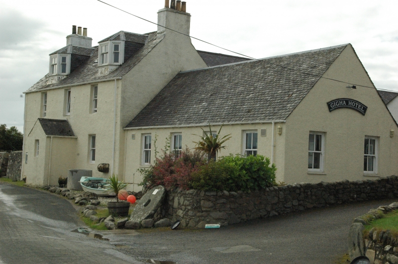
Entry Name: Hotel, Gigha
Listing Name: Gigha Hotel Ardmenish
Listing Date: 20 July 1971
Category: B
Source: Historic Scotland
Source ID: 344034
Historic Scotland Designation Reference: LB11446
Building Class: Cultural
Also known as: Gigha, Hotel
ID on this website: 200344034
Location: Gigha and Cara
County: Argyll and Bute
Electoral Ward: Kintyre and the Islands
Parish: Gigha And Cara
Traditional County: Argyllshire
Tagged with: Hotel
c.1790. Traditional 2 storeys and attic. Harled; gabled
slate roof; piended dormers (later). Gabled porch.
1 storey and attic wing at rear with Steading at end.
(asbestos roof)
Hotel and Farm-house
External links are from the relevant listing authority and, where applicable, Wikidata. Wikidata IDs may be related buildings as well as this specific building. If you want to add or update a link, you will need to do so by editing the Wikidata entry.


Other nearby listed buildings
