Latitude: 56.628 / 56°37'40"N
Longitude: -2.6812 / 2°40'52"W
OS Eastings: 358303
OS Northings: 748666
OS Grid: NO583486
Mapcode National: GBR VS.2K70
Mapcode Global: WH7QP.SNFS
Plus Code: 9C8VJ8H9+5G
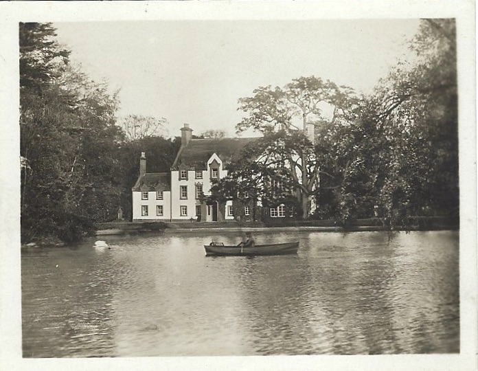
Entry Name: Middleton House
Listing Name: Middleton House
Listing Date: 11 June 1971
Category: B
Source: Historic Scotland
Source ID: 344529
Historic Scotland Designation Reference: LB11919
Building Class: Cultural
ID on this website: 200344529
Location: Kirkden
County: Angus
Electoral Ward: Arbroath West, Letham and Friockheim
Parish: Kirkden
Traditional County: Angus
Tagged with: House
Three-storey mansion house with back wings forming
E-plan. May date 17th cent., altered 18th., and west
front remodelled in tudor-gothic, 1841. Moulded chimney
pieces.
External links are from the relevant listing authority and, where applicable, Wikidata. Wikidata IDs may be related buildings as well as this specific building. If you want to add or update a link, you will need to do so by editing the Wikidata entry.


Other nearby listed buildings