Approximate Location Map
Large Map »
Latitude: 55.884 / 55°53'2"N
Longitude: -5.2846 / 5°17'4"W
OS Eastings: 194666
OS Northings: 670530
OS Grid: NR946705
Mapcode National: GBR FFB5.241
Mapcode Global: WH1L9.SCQL
Plus Code: 9C7PVPM8+J5
Entry Name: Castle Asgog
Listing Name: Castle Ascog, by Ascog Loch (Achoire)
Listing Date: 20 July 1971
Category: B
Source: Historic Scotland
Source ID: 344755
Historic Scotland Designation Reference: LB12082
Building Class: Cultural
ID on this website: 200344755
Location: Kilfinan
County: Argyll and Bute
Electoral Ward: Cowal
Parish: Kilfinan
Traditional County: Argyllshire
Tagged with: Architectural structure
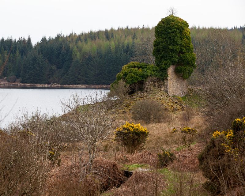
Earlier 15th cent.: Square keep. Random rubble, much
dilapidated. (E. wall destroyed). Roofless. Slit
windows splayed on inside. Interior: Grass-grown floor.
Small chamber with laminated ceiling and moulded
window. Arched alcove at one window.
Stronghold of Lamonts of Ascog until destroyed by
Marquis of Argyll 1646 after a siege.
External links are from the relevant listing authority and, where applicable, Wikidata. Wikidata IDs may be related buildings as well as this specific building. If you want to add or update a link, you will need to do so by editing the Wikidata entry.


