Approximate Location Map
Large Map »
Latitude: 56.518 / 56°31'4"N
Longitude: -4.7707 / 4°46'14"W
OS Eastings: 229637
OS Northings: 739651
OS Grid: NN296396
Mapcode National: GBR GCLH.9HY
Mapcode Global: WH2JL.PFGM
Plus Code: 9C8QG69H+5P
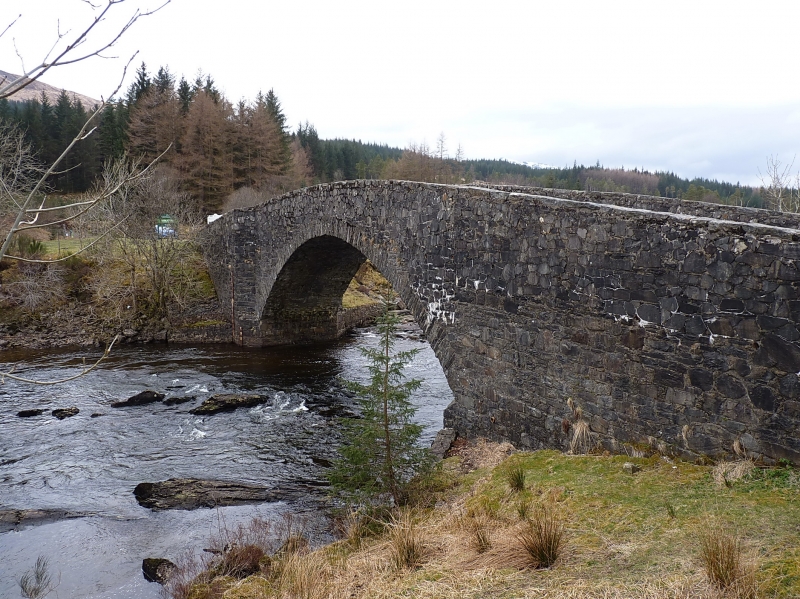
Entry Name: Bridge Of Orchy
Listing Name: Bridge of Orchy River Orchy
Listing Date: 20 July 1971
Category: B
Source: Historic Scotland
Source ID: 344858
Historic Scotland Designation Reference: LB12168
Building Class: Cultural
ID on this website: 200344858
Location: Glenorchy and Inishail
County: Argyll and Bute
Electoral Ward: Oban North and Lorn
Parish: Glenorchy And Inishail
Traditional County: Argyllshire
Tagged with: Road bridge
1742 (?). Segmental arch. Hump-backed. Random rubble.
Flat coping.
On Old Road to Ballachulish and Fort William.
External links are from the relevant listing authority and, where applicable, Wikidata. Wikidata IDs may be related buildings as well as this specific building. If you want to add or update a link, you will need to do so by editing the Wikidata entry.


Other nearby listed buildings
