Approximate Location Map
Large Map »
Latitude: 55.8541 / 55°51'14"N
Longitude: -4.5805 / 4°34'49"W
OS Eastings: 238565
OS Northings: 665332
OS Grid: NS385653
Mapcode National: GBR 3C.49S5
Mapcode Global: WH3P3.M400
Plus Code: 9C7QVC39+JQ
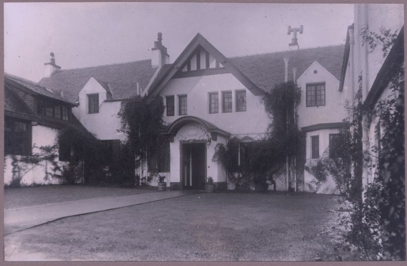
Entry Name: Brannochlie, Prieston Road, Bridge Of Weir
Listing Name: "Brannochlie", Prieston Road, Bridge of Weir
Listing Date: 10 June 1971
Category: B
Source: Historic Scotland
Source ID: 345668
Historic Scotland Designation Reference: LB12771
Building Class: Cultural
Also known as: Bridge Of Weir, Prieston Road, Brannochlie
ID on this website: 200345668
Location: Kilbarchan
County: Renfrewshire
Electoral Ward: Bishopton, Bridge of Weir and Langbank
Parish: Kilbarchan
Traditional County: Renfrewshire
Tagged with: Architectural structure
Two-storey; probably adaptation of former farmhouse; harled;
slated; archt. John A Campbell.
External links are from the relevant listing authority and, where applicable, Wikidata. Wikidata IDs may be related buildings as well as this specific building. If you want to add or update a link, you will need to do so by editing the Wikidata entry.


Other nearby listed buildings
