Latitude: 54.6355 / 54°38'7"N
Longitude: -4.8737 / 4°52'25"W
OS Eastings: 214628
OS Northings: 530504
OS Grid: NX146305
Mapcode National: GBR GJBG.BB0
Mapcode Global: WH2TN.3RG6
Plus Code: 9C6QJ4PG+6G
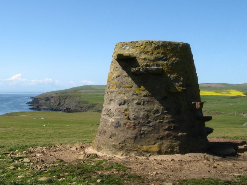
Entry Name: Kennedy's Cairn, Mull Of Galloway
Listing Name: Kennedy's Cairn
Listing Date: 16 March 1994
Category: C
Source: Historic Scotland
Source ID: 346729
Historic Scotland Designation Reference: LB13558
Building Class: Cultural
ID on this website: 200346729
Location: Kirkmaiden
County: Dumfries and Galloway
Electoral Ward: Stranraer and the Rhins
Parish: Kirkmaiden
Traditional County: Wigtownshire
Tagged with: Architectural structure Cairn
Post 1848. Cairn. Cemented rubble. Conical, with flat top. Later cement base. 6 protruding rubble stones forming steps up E side. Cemented rectangular panel to N.
The cairn is not marked on the OS Map of 1848. It is marked as "Kennedy's Cairn" on the OS Map of 1906.
External links are from the relevant listing authority and, where applicable, Wikidata. Wikidata IDs may be related buildings as well as this specific building. If you want to add or update a link, you will need to do so by editing the Wikidata entry.


Other nearby listed buildings