Approximate Location Map
Large Map »
Latitude: 56.8803 / 56°52'49"N
Longitude: -6.1331 / 6°7'59"W
OS Eastings: 148298
OS Northings: 784157
OS Grid: NM482841
Mapcode National: GBR CB7J.PJZ
Mapcode Global: WGZBS.RBPB
Plus Code: 9C8MVVJ8+4Q
Entry Name: Clanranald Harbour, Eigg
Listing Name: Isle of Eigg, Clanranald Harbour
Listing Date: 5 October 1971
Category: C
Source: Historic Scotland
Source ID: 347393
Historic Scotland Designation Reference: LB14110
Building Class: Cultural
ID on this website: 200347393
Location: Small Isles
County: Highland
Electoral Ward: Caol and Mallaig
Parish: Small Isles
Tagged with: Architectural structure
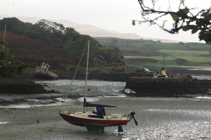
Circa 1790. Simple rubble basin consisting of 2 L-shaped arms, utilising and linking natural rocky outcrops, with centre entrance at south. SW arm in poor condition.
Basin much silted up. Eigg was part of Clanranald of Arisaig lands.
External links are from the relevant listing authority and, where applicable, Wikidata. Wikidata IDs may be related buildings as well as this specific building. If you want to add or update a link, you will need to do so by editing the Wikidata entry.


Other nearby listed buildings
