Latitude: 56.0001 / 56°0'0"N
Longitude: -2.6526 / 2°39'9"W
OS Eastings: 359397
OS Northings: 678767
OS Grid: NT593787
Mapcode National: GBR 2X.TXPT
Mapcode Global: WH8VY.7G32
Plus Code: 9C8V282W+3X
Entry Name: East Range, Farmsteading, Smeaton House
Listing Name: Smeaton-Hepburn Farm Steading East Range
Listing Date: 2 May 1990
Category: B
Source: Historic Scotland
Source ID: 347889
Historic Scotland Designation Reference: LB14523
Building Class: Cultural
ID on this website: 200347889
Location: Prestonkirk
County: East Lothian
Electoral Ward: Dunbar and East Linton
Parish: Prestonkirk
Traditional County: East Lothian
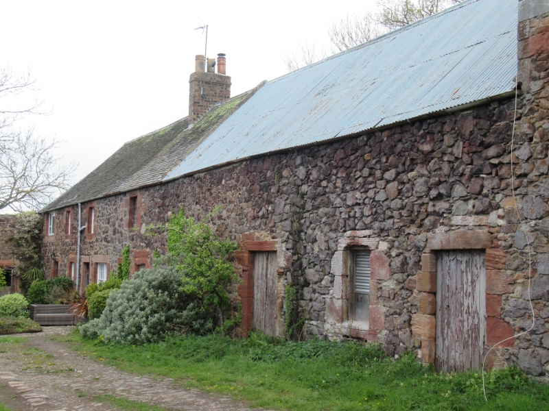
Mid-later 18th century. Granary with adjoining 2-storey
cottages, forming E range of U-plan steading; much
altered. Random whinstone rubble, mixed ashlar
dressings with broad droving, many stones renewed.
Granary with cart openings, possibly raised in early
19th century to provide loft. Cart-arch to outer left
now covered by modern door. Windows flanking; single bay
to left, 2 bays to right, now blocked. Granary loft
above with 3 small openings now blocked. Change in
masonry at quoins suggests possible raising.
S gable with cart-arch and 2 pitching holes above, now
blocked. Further pitching hole to loft.
At rear, loading doorway raised between floors with
smaller openings flanking, 3 windows to loft, now
blocked.
Lower range adjoining to left with 2 doorways and window
at ground floor, large modern sliding door at rear.
Range continuing to N. with 2 two storey farm cottages,
openings much altered; various glazing. Grey slates to
cartshed and granary and cottages; corrugated iron to
middle range. Straight skews; brick stack to cottages.
Unusual form for a granary; not multi-arched cartshed
with granary above. Possibly a girnal house for storing
landowner's grain; high doorways suggest grain may have
been stored on the sheaf, although it was more usually
stored on corn ricks out of doors.


Other nearby listed buildings