Approximate Location Map
Large Map »
Latitude: 57.3827 / 57°22'57"N
Longitude: -4.0377 / 4°2'15"W
OS Eastings: 277591
OS Northings: 834314
OS Grid: NH775343
Mapcode National: GBR J9D6.P5J
Mapcode Global: WH4GY.YPFP
Plus Code: 9C9Q9XM6+3W
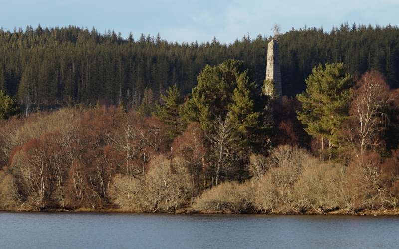
Entry Name: Obelisk, Isle Of Moy
Listing Name: Moy Obelisk (On Island in Loch Moy)
Listing Date: 5 October 1971
Category: B
Source: Historic Scotland
Source ID: 348364
Historic Scotland Designation Reference: LB14889
Building Class: Cultural
Also known as: Isle Of Moy, Obelisk
ID on this website: 200348364
Location: Moy and Dalarossie
County: Highland
Electoral Ward: Inverness South
Parish: Moy And Dalarossie
Traditional County: Inverness-shire
Tagged with: Obelisk
1824. Granite obelisk, 70' tall standing on base approximately
20' square. Plaque with inscription inserted in base.
Erected by Dame Margaret Mackintosh in memory of her husband,
Sir Aeneas Mackintosh (d 1820) who is eulogised in long poetic inscription.
External links are from the relevant listing authority and, where applicable, Wikidata. Wikidata IDs may be related buildings as well as this specific building. If you want to add or update a link, you will need to do so by editing the Wikidata entry.


Other nearby listed buildings
