Approximate Location Map
Large Map »
Latitude: 57.1817 / 57°10'54"N
Longitude: -2.2277 / 2°13'39"W
OS Eastings: 386335
OS Northings: 810117
OS Grid: NJ863101
Mapcode National: GBR XJ.M6QY
Mapcode Global: WH9QG.RRDB
Plus Code: 9C9V5QJC+MW
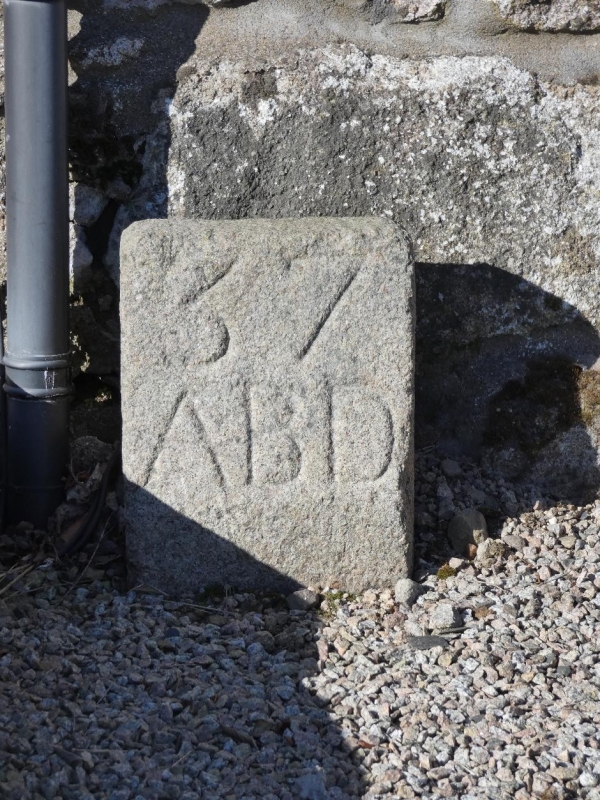
Entry Name: Boundary Marker 37, East Wall, Steading, Ashtown, Aberdeen
Listing Name: March Stone No 37 Ashtown Farm
Listing Date: 26 May 1977
Category: B
Source: Historic Scotland
Source ID: 349392
Historic Scotland Designation Reference: LB15707
Building Class: Cultural
ID on this website: 200349392
Location: Newhills
County: Aberdeen
Electoral Ward: Dyce/Bucksburn/Danestone
Parish: Newhills
Traditional County: Aberdeenshire
Tagged with: Boundary marker
Short standing granite stone inscribed '37 ABD'.
At East wall of steading of Ashtown Farm.
External links are from the relevant listing authority and, where applicable, Wikidata. Wikidata IDs may be related buildings as well as this specific building. If you want to add or update a link, you will need to do so by editing the Wikidata entry.


Other nearby listed buildings
