Approximate Location Map
Large Map »
Latitude: 57.1188 / 57°7'7"N
Longitude: -2.2075 / 2°12'27"W
OS Eastings: 387531
OS Northings: 803111
OS Grid: NJ875031
Mapcode National: GBR XJ.RKBJ
Mapcode Global: WH9QW.2B2J
Plus Code: 9C9V4Q9R+GX
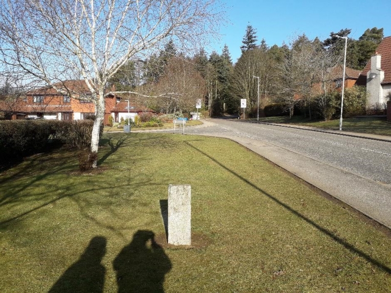
Entry Name: Boundary Marker 15, Bailliewells Farm, Aberdeen
Listing Name: March Stone No. 15 in a Field South of Bellyswells Farm and Beside 4 Dressed Stones Marked 1-4 Which Mark the Springs of Cults Water Supply.
Listing Date: 16 April 1971
Category: B
Source: Historic Scotland
Source ID: 349424
Historic Scotland Designation Reference: LB15739
Building Class: Cultural
ID on this website: 200349424
Location: Peterculter
County: Aberdeen
Electoral Ward: Lower Deeside
Parish: Peterculter
Traditional County: Aberdeenshire
Tagged with: Boundary marker
Marked ABD 15, Simple granite stone tapered at top.
External links are from the relevant listing authority and, where applicable, Wikidata. Wikidata IDs may be related buildings as well as this specific building. If you want to add or update a link, you will need to do so by editing the Wikidata entry.


Other nearby listed buildings
