Approximate Location Map
Large Map »
Latitude: 56.2784 / 56°16'42"N
Longitude: -3.2682 / 3°16'5"W
OS Eastings: 321573
OS Northings: 710274
OS Grid: NO215102
Mapcode National: GBR 25.8HQ2
Mapcode Global: WH6R0.RGX7
Plus Code: 9C8R7PHJ+9P
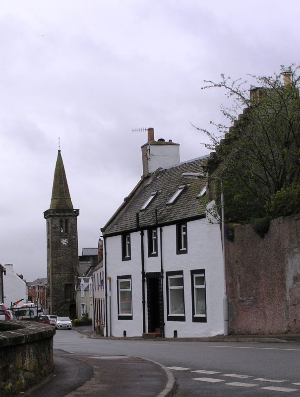
Entry Name: 27 High St, Strathmiglo
Listing Name: 27 High Street
Listing Date: 22 October 1984
Category: C
Source: Historic Scotland
Source ID: 349436
Historic Scotland Designation Reference: LB15751
Building Class: Cultural
ID on this website: 200349436
Location: Strathmiglo
County: Fife
Electoral Ward: Howe of Fife and Tay Coast
Parish: Strathmiglo
Traditional County: Fife
Tagged with: House
Mid 18th century 2-storey 3 window harled and whitewashed, flat arched doorpiece with channelled joints, ground floor windows enlarged later; W gable straight skews stepped in middle, moulded skew end. Slated (adjoining part demolished house has crowstepped mutual gable and
door lintel IL M.M 1732 now effaced).
External links are from the relevant listing authority and, where applicable, Wikidata. Wikidata IDs may be related buildings as well as this specific building. If you want to add or update a link, you will need to do so by editing the Wikidata entry.


Other nearby listed buildings
