Latitude: 56.278 / 56°16'40"N
Longitude: -3.2704 / 3°16'13"W
OS Eastings: 321435
OS Northings: 710233
OS Grid: NO214102
Mapcode National: GBR 25.8H6V
Mapcode Global: WH6R0.QGVJ
Plus Code: 9C8R7PHH+6R
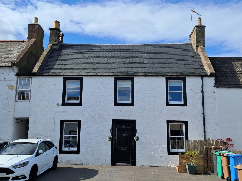
Entry Name: Stratheden Hotel (west wing), 61 High Street, Strathmiglo
Listing Name: Stratheden Hotel High Street
Listing Date: 22 October 1984
Category: C
Source: Historic Scotland
Source ID: 349441
Historic Scotland Designation Reference: LB15756
Building Class: Cultural
ID on this website: 200349441
Location: Strathmiglo
County: Fife
Electoral Ward: Howe of Fife and Tay Coast
Parish: Strathmiglo
Traditional County: Fife
Tagged with: Architectural structure
East block: early 19th century, 2-storey 3-window whitewashed droved rubble, black painted margins chamfered in Victorian times Slated. West block: 18th century 2-storey 3-windows whitewashed rubble, black painted margins and eaves course; scroll skews to front, crowsteps to back. Single storey piend roofed front addition. Slated.
External links are from the relevant listing authority and, where applicable, Wikidata. Wikidata IDs may be related buildings as well as this specific building. If you want to add or update a link, you will need to do so by editing the Wikidata entry.


Other nearby listed buildings