Approximate Location Map
Large Map »
Latitude: 56.3135 / 56°18'48"N
Longitude: -2.7098 / 2°42'35"W
OS Eastings: 356190
OS Northings: 713679
OS Grid: NO561136
Mapcode National: GBR 2V.694D
Mapcode Global: WH7S7.BKWW
Plus Code: 9C8V877R+93
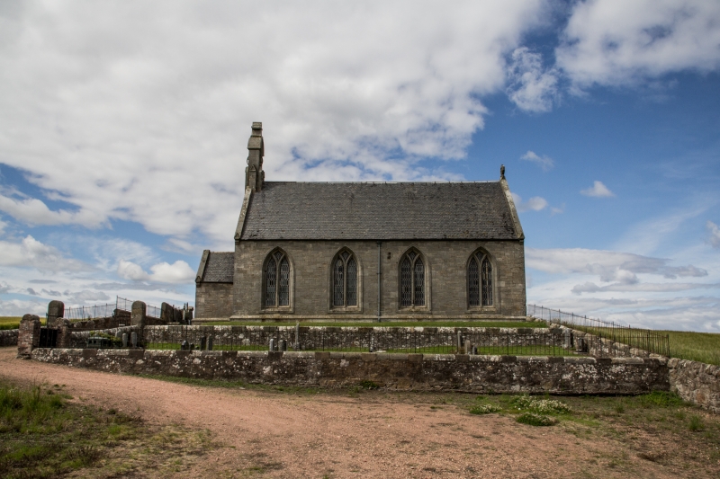
Entry Name: Boarhills Parish Church And Churchyard
Listing Name: Boarhills Parish Kirk
Listing Date: 22 October 1984
Category: C
Source: Historic Scotland
Source ID: 349525
Historic Scotland Designation Reference: LB15835
Building Class: Cultural
ID on this website: 200349525
Location: St Andrews and St Leonards
County: Fife
Electoral Ward: East Neuk and Landward
Parish: St Andrews And St Leonards
Traditional County: Fife
Tagged with: Church building Churchyard
George Rae 1866-7. Simple Gothic snecked rubble rectangle, 4 windows of 2 lights with plain Y-tracery. Arched bellcote and porch W gable.
Ecclesiastical building in use as much.
External links are from the relevant listing authority and, where applicable, Wikidata. Wikidata IDs may be related buildings as well as this specific building. If you want to add or update a link, you will need to do so by editing the Wikidata entry.


Other nearby listed buildings
