Approximate Location Map
Large Map »
Latitude: 57.3315 / 57°19'53"N
Longitude: -2.8336 / 2°50'0"W
OS Eastings: 349911
OS Northings: 827085
OS Grid: NJ499270
Mapcode National: GBR M9CB.W2L
Mapcode Global: WH7M4.FZXG
Plus Code: 9C9V85J8+JH
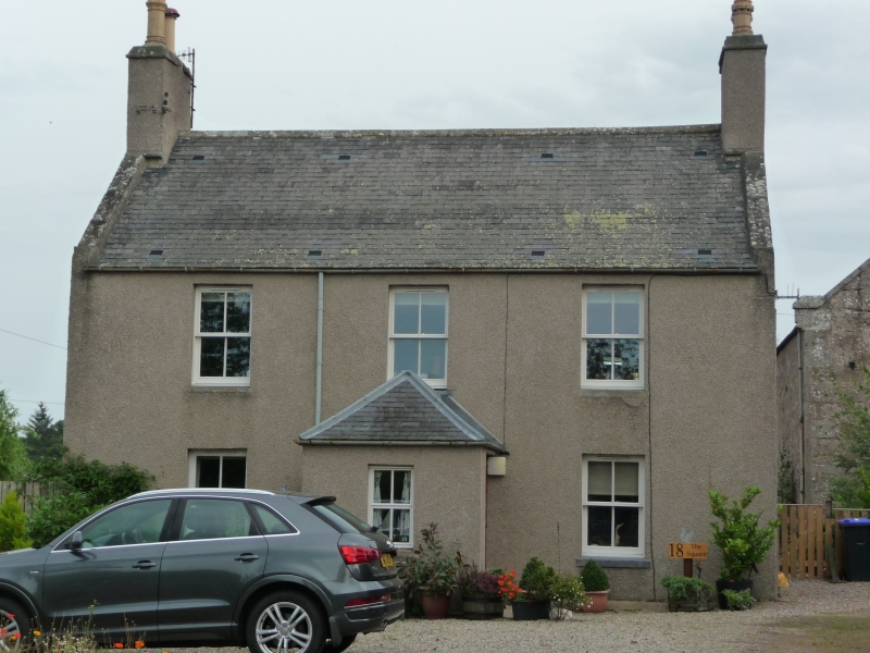
Entry Name: 18 The Square, Rhynie
Listing Name: 18 the Square
Listing Date: 11 September 1984
Category: C
Source: Historic Scotland
Source ID: 349745
Historic Scotland Designation Reference: LB16037
Building Class: Cultural
ID on this website: 200349745
Location: Rhynie
County: Aberdeenshire
Electoral Ward: Huntly, Strathbogie and Howe of Alford
Parish: Rhynie
Traditional County: Aberdeenshire
Tagged with: House
Early 19th century. 2-storey 3-window with piend roofed
porch and moulded chimney copes. Harled.
External links are from the relevant listing authority and, where applicable, Wikidata. Wikidata IDs may be related buildings as well as this specific building. If you want to add or update a link, you will need to do so by editing the Wikidata entry.


Other nearby listed buildings
