Latitude: 57.5231 / 57°31'23"N
Longitude: -2.0541 / 2°3'14"W
OS Eastings: 396855
OS Northings: 848107
OS Grid: NJ968481
Mapcode National: GBR P88V.5M9
Mapcode Global: WH9P0.F52J
Plus Code: 9C9VGWFW+68
Entry Name: Deer Abbey
Listing Date: 16 April 1971
Category: B
Source: Historic Scotland
Source ID: 349816
Historic Scotland Designation Reference: LB16104
Building Class: Cultural
ID on this website: 200349816
Location: Old Deer
County: Aberdeenshire
Electoral Ward: Central Buchan
Parish: Old Deer
Traditional County: Aberdeenshire
Tagged with: Romanesque architecture Monastery ruins Cistercian monastery
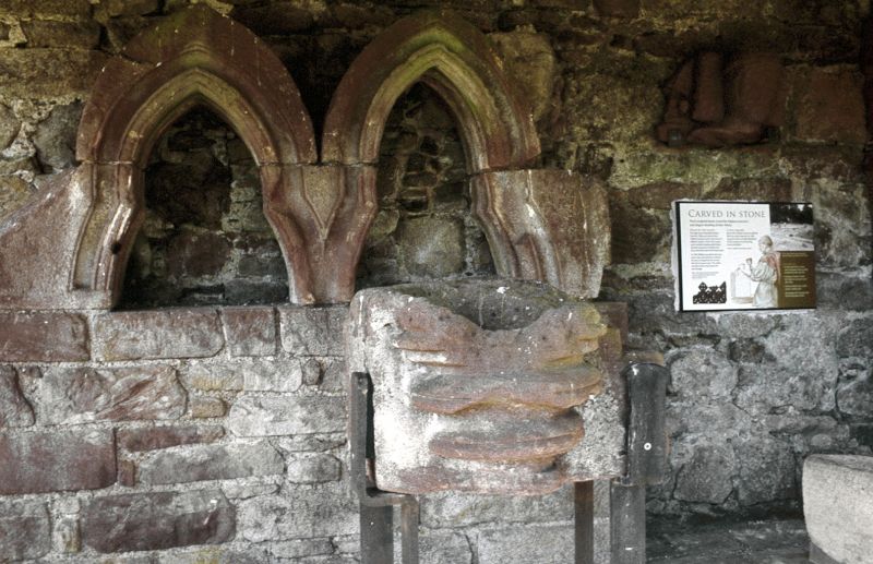
Founded 1219 by William 1st Earl of Buchan. Of church (cruciform 157 long, N. aisle to nave and E aisle to S. transept) only footings, bungled piscina and other fragments remain. Ruins razed 1854. Cloister approx. 70' x 90', considerable remains of S. range, rubble-built with unmoulded round-headed arches.
Guardianship Monument. Scheduled 6 February 1996.
External links are from the relevant listing authority and, where applicable, Wikidata. Wikidata IDs may be related buildings as well as this specific building. If you want to add or update a link, you will need to do so by editing the Wikidata entry.


Other nearby listed buildings