Approximate Location Map
Large Map »
Latitude: 57.2799 / 57°16'47"N
Longitude: -2.2327 / 2°13'57"W
OS Eastings: 386070
OS Northings: 821057
OS Grid: NJ860210
Mapcode National: GBR XH.4ZGZ
Mapcode Global: WH9Q2.P80Z
Plus Code: 9C9V7QH8+XW
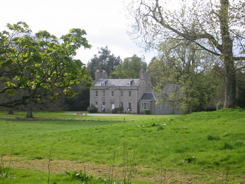
Entry Name: Straloch House
Listing Name: Straloch House
Listing Date: 24 November 1972
Category: A
Source: Historic Scotland
Source ID: 349839
Historic Scotland Designation Reference: LB16125
Building Class: Cultural
ID on this website: 200349839
Location: New Machar
County: Aberdeenshire
Electoral Ward: East Garioch
Parish: New Machar
Traditional County: Aberdeenshire
Tagged with: House
5 window, 2 storey and attic with 2 end wings: 1780. Harled
slated curvlinear gables.
Straloch belonged to Gordons, later to Ramsay's (N.S.A.)
External links are from the relevant listing authority and, where applicable, Wikidata. Wikidata IDs may be related buildings as well as this specific building. If you want to add or update a link, you will need to do so by editing the Wikidata entry.


Other nearby listed buildings
