Approximate Location Map
Large Map »
Latitude: 56.0609 / 56°3'39"N
Longitude: -3.5881 / 3°35'17"W
OS Eastings: 301210
OS Northings: 686481
OS Grid: NT012864
Mapcode National: GBR 1S.Q3W3
Mapcode Global: WH5QP.VXKH
Plus Code: 9C8R3C66+9Q
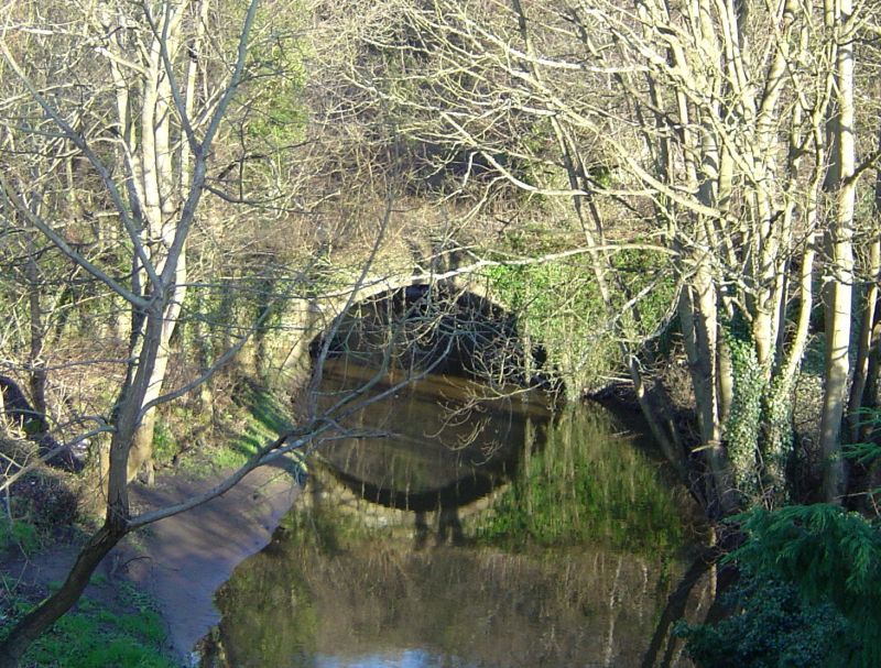
Entry Name: Old Bridge, Bluther Burn, Newmills
Listing Name: Newmills Old Bridge over Bluther Burn.
Listing Date: 19 December 1979
Category: C
Source: Historic Scotland
Source ID: 350383
Historic Scotland Designation Reference: LB16617
Building Class: Cultural
ID on this website: 200350383
Location: Torryburn
County: Fife
Electoral Ward: West Fife and Coastal Villages
Parish: Torryburn
Traditional County: Fife
Tagged with: Road bridge
Small semi-circular arch, rubble, voussoirs with chamfered
arrises. Disused probably 17th cent; widened 18th century.
Smaller arch over lade at west end. Parapets gone.
External links are from the relevant listing authority and, where applicable, Wikidata. Wikidata IDs may be related buildings as well as this specific building. If you want to add or update a link, you will need to do so by editing the Wikidata entry.


Other nearby listed buildings
