Approximate Location Map
Large Map »
Latitude: 56.1233 / 56°7'23"N
Longitude: -3.5885 / 3°35'18"W
OS Eastings: 301345
OS Northings: 693423
OS Grid: NT013934
Mapcode National: GBR 1S.L9S5
Mapcode Global: WH5QH.VCC4
Plus Code: 9C8R4CF6+8J
Entry Name: Steading, Devonside
Listing Name: Devonside Farm Steading
Listing Date: 19 December 1979
Category: C
Source: Historic Scotland
Source ID: 350847
Historic Scotland Designation Reference: LB17004
Building Class: Cultural
ID on this website: 200350847
Location: Saline
County: Fife
Electoral Ward: West Fife and Coastal Villages
Parish: Saline
Traditional County: Fife
Tagged with: Farmstead
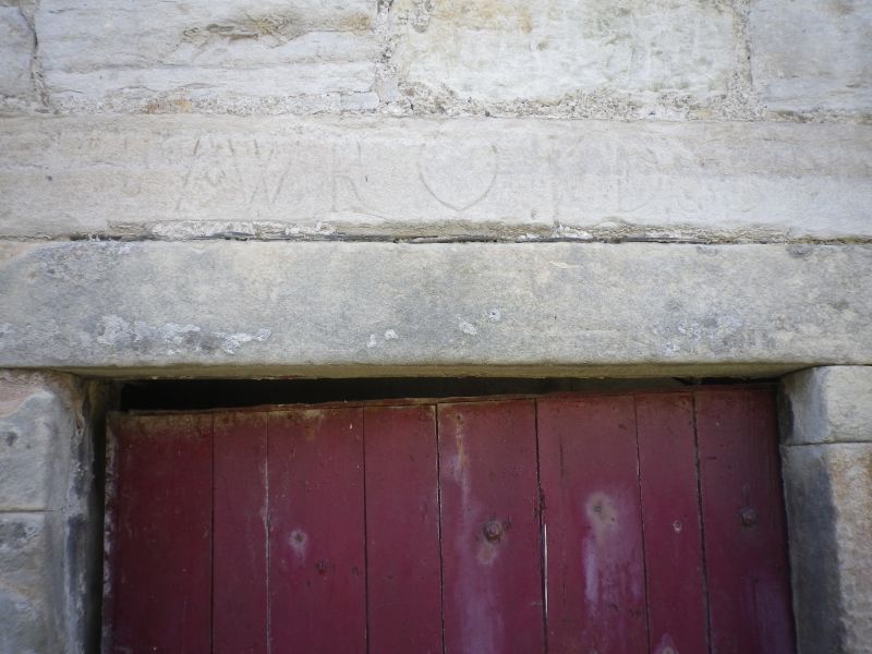
Symmetrical, ashlar, south front with quarterfoil pigeon
entry and battlemented wings. Probably early 19th cent. In
courtyard are two lintels inscribed, 17 WR KD 35 and 36.
External links are from the relevant listing authority and, where applicable, Wikidata. Wikidata IDs may be related buildings as well as this specific building. If you want to add or update a link, you will need to do so by editing the Wikidata entry.


Other nearby listed buildings
