Approximate Location Map
Large Map »
Latitude: 56.1151 / 56°6'54"N
Longitude: -3.5755 / 3°34'31"W
OS Eastings: 302129
OS Northings: 692493
OS Grid: NT021924
Mapcode National: GBR 1T.LLPM
Mapcode Global: WH5QJ.1KMF
Plus Code: 9C8R4C8F+3Q
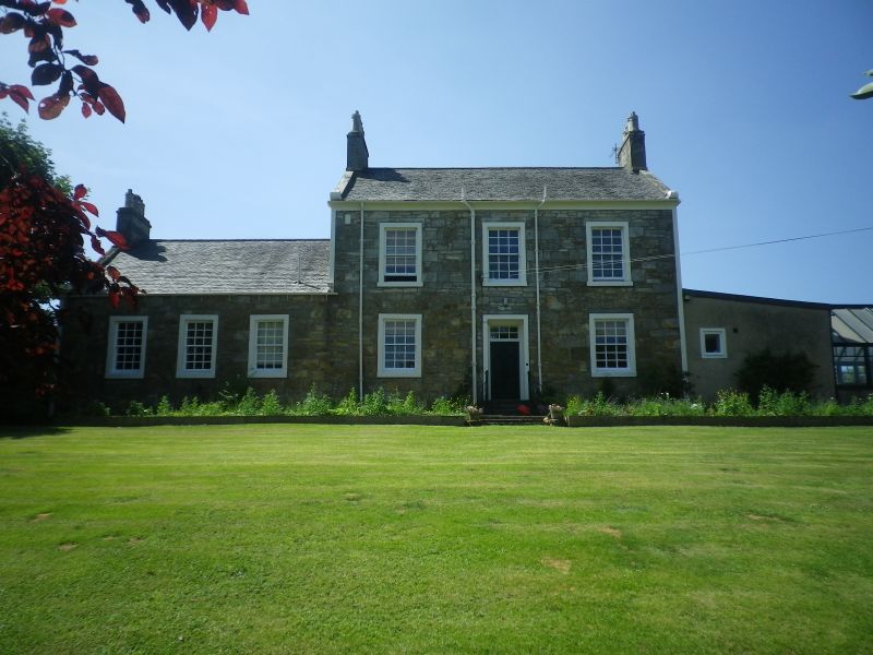
Entry Name: Claverley, West Road, Saline
Listing Name: 'Claverley' West Road, Saline
Listing Date: 20 June 1972
Category: B
Source: Historic Scotland
Source ID: 350873
Historic Scotland Designation Reference: LB17026
Building Class: Cultural
Also known as: Saline, West Road, Claverley
ID on this website: 200350873
Location: Saline
County: Fife
Electoral Ward: West Fife and Coastal Villages
Parish: Saline
Traditional County: Fife
Tagged with: Architectural structure
Two-storey house with single-storey wing; harl and slate;
scroll skewputs. Early 19th cent.
Two-storey part was school-house and one-storey wing was
school-room until opening of public school (1875)
External links are from the relevant listing authority and, where applicable, Wikidata. Wikidata IDs may be related buildings as well as this specific building. If you want to add or update a link, you will need to do so by editing the Wikidata entry.


Other nearby listed buildings
