Approximate Location Map
Large Map »
Latitude: 58.9233 / 58°55'23"N
Longitude: -3.1468 / 3°8'48"W
OS Eastings: 334065
OS Northings: 1004567
OS Grid: HY340045
Mapcode National: GBR L5L4.P5Q
Mapcode Global: WH6B3.MZQ6
Plus Code: 9CCRWVF3+87
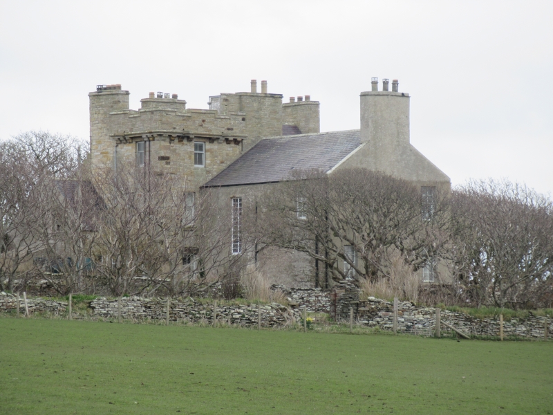
Entry Name: Orphir House
Listing Name: Orphir House (Hall of Gyre)
Listing Date: 9 December 1977
Category: C
Source: Historic Scotland
Source ID: 352649
Historic Scotland Designation Reference: LB18578
Building Class: Cultural
ID on this website: 200352649
Location: Orphir
County: Orkney Islands
Electoral Ward: Kirkwall West and Orphir
Parish: Orphir
Traditional County: Orkney
Tagged with: House
Main block built 1886 on site of earlier house built
c.1795. Sneck rubble. Slated roof. Corbie-steps.
Crenellated tower. W. wing was built 1851. E. wing may be
17th or 18th cents.
Gyre was bought by William Halcro of Coubister 1737 and
remains in his family. Mansion was built for James Halcro
Johnston of Coubister.
External links are from the relevant listing authority and, where applicable, Wikidata. Wikidata IDs may be related buildings as well as this specific building. If you want to add or update a link, you will need to do so by editing the Wikidata entry.


Other nearby listed buildings
