Latitude: 55.3033 / 55°18'11"N
Longitude: -4.5353 / 4°32'7"W
OS Eastings: 239155
OS Northings: 603948
OS Grid: NS391039
Mapcode National: GBR 4F.7S2F
Mapcode Global: WH3RN.9YKT
Plus Code: 9C7Q8F37+8V
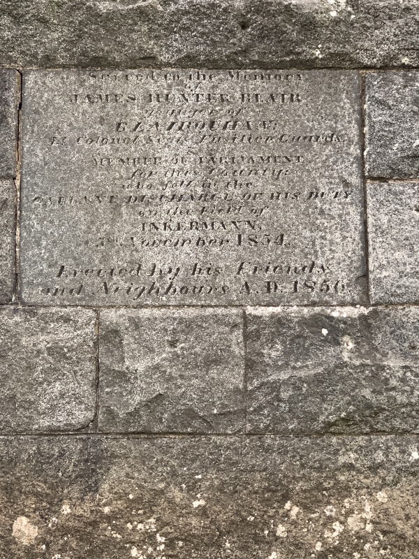
Entry Name: Colonel Hunter Blair's Monument
Listing Name: Colonel Hunter Blair's Monument
Listing Date: 14 April 1971
Category: B
Source: Historic Scotland
Source ID: 353393
Historic Scotland Designation Reference: LB19104
Building Class: Cultural
ID on this website: 200353393
Location: Straiton
County: South Ayrshire
Electoral Ward: Maybole, North Carrick and Coylton
Parish: Straiton
Traditional County: Ayrshire
Tagged with: Monument
Stone obelisk on Highgate Hill.
External links are from the relevant listing authority and, where applicable, Wikidata. Wikidata IDs may be related buildings as well as this specific building. If you want to add or update a link, you will need to do so by editing the Wikidata entry.


Other nearby listed buildings