Latitude: 57.5596 / 57°33'34"N
Longitude: -2.3246 / 2°19'28"W
OS Eastings: 380677
OS Northings: 852210
OS Grid: NJ806522
Mapcode National: GBR N8MR.1RS
Mapcode Global: WH8MK.8893
Plus Code: 9C9VHM5G+R5
Entry Name: Old Hall Buildings, Garmond
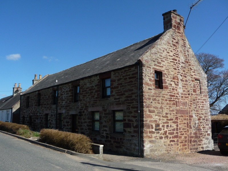
Listing Name: Old Hall Buildings, Garmond.
Listing Date: 15 February 1982
Category: C
Source: Historic Scotland
Source ID: 354191
Historic Scotland Designation Reference: LB19777
Building Class: Cultural
ID on this website: 200354191
Location: Monquhitter
County: Aberdeenshire
Electoral Ward: Turriff and District
Parish: Monquhitter
Traditional County: Aberdeenshire
Tagged with: House
Late 18th century 2-storey red rubble, blocked doorway in S.
gable with relieving arch.
Garmond, like Cuminestown contains a fair number of 18th
century houses all now altered. It was founded later.
External links are from the relevant listing authority and, where applicable, Wikidata. Wikidata IDs may be related buildings as well as this specific building. If you want to add or update a link, you will need to do so by editing the Wikidata entry.


Other nearby listed buildings