Approximate Location Map
Large Map »
Latitude: 57.1974 / 57°11'50"N
Longitude: -3.0806 / 3°4'50"W
OS Eastings: 334800
OS Northings: 812366
OS Grid: NJ348123
Mapcode National: GBR WD.0G5F
Mapcode Global: WH6LN.NC76
Plus Code: 9C9R5WW9+XQ
Entry Name: Toll House, Water Of Carvie, Poldullie
Listing Name: Poldullie Toll House
Listing Date: 11 September 1984
Category: C
Source: Historic Scotland
Source ID: 354197
Historic Scotland Designation Reference: LB19783
Building Class: Cultural
ID on this website: 200354197
Location: Strathdon
County: Aberdeenshire
Electoral Ward: Aboyne, Upper Deeside and Donside
Parish: Strathdon
Traditional County: Aberdeenshire
Tagged with: Tollhouse
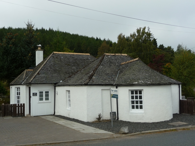
Circa 1800, extended later 20th century. Distinctive single storey, 3-bay former toll house on main Corgarff to Strathdon road, with prominent bow front and pavilion roofs. Harled.
FURTHER DESCRIPTION: symmetrical entrance elevation to SE with 2 windows to projecting bowed bay at centre, further window to right and blocked opening to left. Later slightly larger rectangular-plan addition off-set at rear.
12-pane glazing pattern in timber sash and case windows, some with trickle vents. Small grey slates. Harled stack.
INTERIOR: modern.
Poldullie retains its early toll house appearance, and has been extended from an original 2 room rectangle with bowed front. The turnpike road runs through the parish for eighteen miles, and terminates at Corgarff. Probably originally known as Strathdon Toll House, the Aberdeen Roads Act of 1865 formally ended turnpike charges and the house appears on the 1st Ordnance Survey map as 'Bridgeley'. The New Statistical Account comments upon the vast improvement to the country derived from 'the opening up of the strath by a turnpike road running through the centre of the parish; and the formation of good cross-roads with stone bridges over the difference streams'. The 1715 Poldullie Bridge is situated just to the north east of the toll house. The separately listed Colnabaichin Toll House is situated a few miles to the east of Poldullie at the junction with the Braemar road.
External links are from the relevant listing authority and, where applicable, Wikidata. Wikidata IDs may be related buildings as well as this specific building. If you want to add or update a link, you will need to do so by editing the Wikidata entry.


Other nearby listed buildings
