Latitude: 57.2431 / 57°14'35"N
Longitude: -2.7285 / 2°43'42"W
OS Eastings: 356134
OS Northings: 817166
OS Grid: NJ561171
Mapcode National: GBR M9ML.2S6
Mapcode Global: WH7MS.260Q
Plus Code: 9C9V67VC+6J
Entry Name: Bridge Of Alford
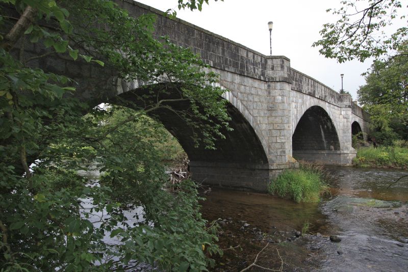
Listing Name: Bridge of Alford over River Don
Listing Date: 16 April 1971
Category: B
Source: Historic Scotland
Source ID: 354199
Historic Scotland Designation Reference: LB19785
Building Class: Cultural
ID on this website: 200354199
Location: Tullynessle and Forbes
County: Aberdeenshire
Electoral Ward: Huntly, Strathbogie and Howe of Alford
Parish: Tullynessle And Forbes
Traditional County: Aberdeenshire
Tagged with: Road bridge
1810-11 repaired 1829. 3 segmental arches, rough ashlar with
cutwater refuges; curved approaches.
External links are from the relevant listing authority and, where applicable, Wikidata. Wikidata IDs may be related buildings as well as this specific building. If you want to add or update a link, you will need to do so by editing the Wikidata entry.


Other nearby listed buildings