Latitude: 58.9492 / 58°56'57"N
Longitude: -3.2261 / 3°13'33"W
OS Eastings: 329553
OS Northings: 1007532
OS Grid: HY295075
Mapcode National: GBR L5D2.GX3
Mapcode Global: WH6B2.DBZ9
Plus Code: 9CCRWQXF+MH
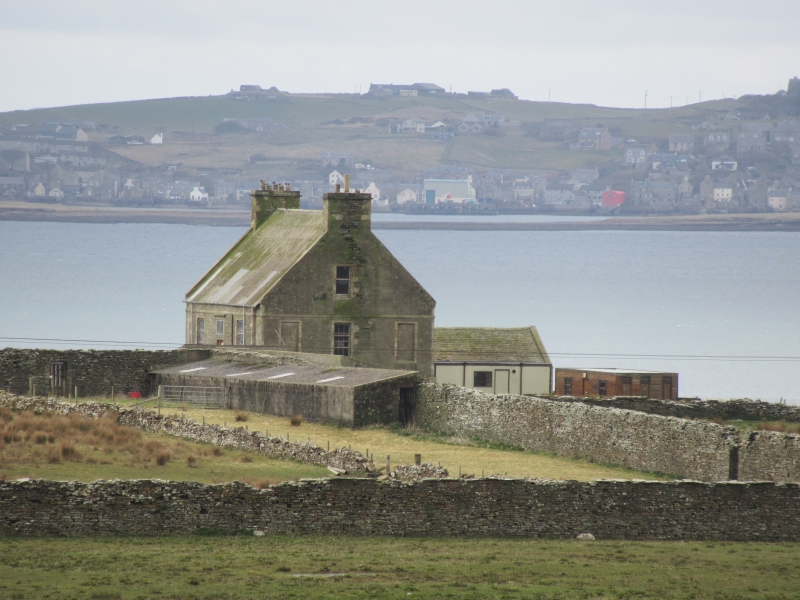
Entry Name: Hall Of Clestrain
Listing Name: Hall of Clestrain
Listing Date: 8 December 1971
Category: A
Source: Historic Scotland
Source ID: 354311
Historic Scotland Designation Reference: LB19892
Building Class: Cultural
ID on this website: 200354311
Location: Orphir
County: Orkney Islands
Electoral Ward: Kirkwall West and Orphir
Parish: Orphir
Traditional County: Orkney
Tagged with: Farmstead
1769. Georgian. 1 1/2-storeys on basement. Harled; dressed face-work. Low moulded doorway approached by stair. Gabled ends. Modern asbestos roof.
Unusual. Clestrain passed from Stewarts to Honymans c.1700. Earlier Hall was raided 10th Feb. 1725 by John Gow's pirate crew. Present Hall built for Patrick Honyman, 3rd of Graemsay. Now derelict.
External links are from the relevant listing authority and, where applicable, Wikidata. Wikidata IDs may be related buildings as well as this specific building. If you want to add or update a link, you will need to do so by editing the Wikidata entry.