Approximate Location Map
Large Map »
Latitude: 57.1655 / 57°9'55"N
Longitude: -2.1405 / 2°8'25"W
OS Eastings: 391602
OS Northings: 808308
OS Grid: NJ916083
Mapcode National: GBR S5F.WP
Mapcode Global: WH9QQ.25Z4
Plus Code: 9C9V5V85+6R
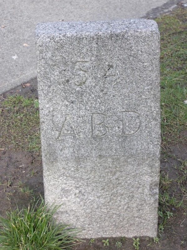
Entry Name: Boundary Marker 54, Provost Rust Drive, Aberdeen
Listing Name: March Stone No. 54, at Junction of Provost Rust Drive and Smithfield Drive
Listing Date: 12 January 1967
Category: B
Source: Historic Scotland
Source ID: 354476
Historic Scotland Designation Reference: LB20034
Building Class: Cultural
ID on this website: 200354476
Location: Aberdeen
County: Aberdeen
Town: Aberdeen
Electoral Ward: Northfield/Mastrick North
Traditional County: Aberdeenshire
Tagged with: Boundary marker
Marked 54 ABD.
Description of siting at Hilton Road junction with Back
Hilton Road in Freedom Lands.
External links are from the relevant listing authority and, where applicable, Wikidata. Wikidata IDs may be related buildings as well as this specific building. If you want to add or update a link, you will need to do so by editing the Wikidata entry.


Other nearby listed buildings
