Approximate Location Map
Large Map »
Latitude: 56.2921 / 56°17'31"N
Longitude: -3.234 / 3°14'2"W
OS Eastings: 323717
OS Northings: 711756
OS Grid: NO237117
Mapcode National: GBR 26.7KDZ
Mapcode Global: WH6R1.937R
Plus Code: 9C8R7QR8+R9
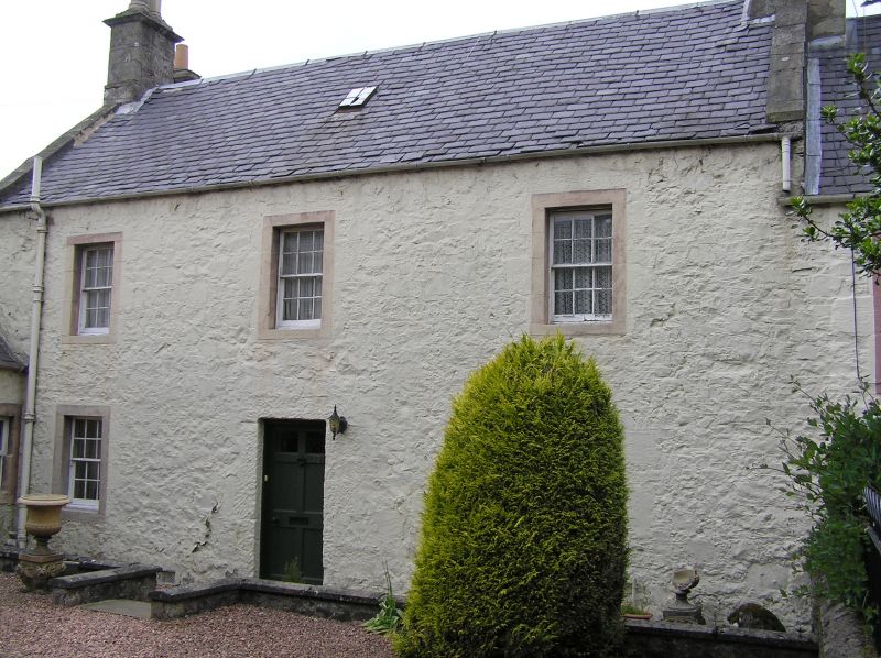
Entry Name: Orchard House, 39 High Street, Auchtermuchty
Listing Name: Orchard House, High Street
Listing Date: 18 August 1972
Category: B
Source: Historic Scotland
Source ID: 356670
Historic Scotland Designation Reference: LB21394
Building Class: Cultural
Also known as: Auchtermuchty, 39 High Street, Orchard House
ID on this website: 200356670
Location: Auchtermuchty
County: Fife
Town: Auchtermuchty
Electoral Ward: Howe of Fife and Tay Coast
Traditional County: Fife
Tagged with: Building
Late 18th century. 2-storey 3-window painted rubble with
painted margins, crowstepped at back, slated; cottage at
right angles now absorbed into it and roofless cottage on
south; lintel inscribed IF KT 1657.
External links are from the relevant listing authority and, where applicable, Wikidata. Wikidata IDs may be related buildings as well as this specific building. If you want to add or update a link, you will need to do so by editing the Wikidata entry.


Other nearby listed buildings
