Approximate Location Map
Large Map »
Latitude: 56.2945 / 56°17'40"N
Longitude: -3.2349 / 3°14'5"W
OS Eastings: 323668
OS Northings: 712022
OS Grid: NO236120
Mapcode National: GBR 26.7K6N
Mapcode Global: WH6R1.81TX
Plus Code: 9C8R7QV8+Q3
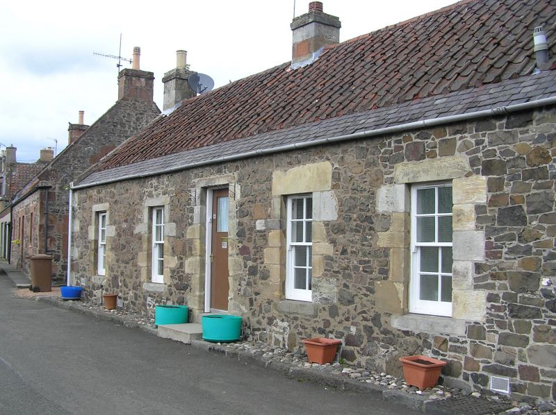
Entry Name: 21 Upper Greens, Auchtermuchty
Listing Name: House (D Ford) Upper Greens
Listing Date: 18 August 1972
Category: B
Source: Historic Scotland
Source ID: 356732
Historic Scotland Designation Reference: LB21452
Building Class: Cultural
Also known as: Auchtermuchty, 21 Upper Greens
ID on this website: 200356732
Location: Auchtermuchty
County: Fife
Town: Auchtermuchty
Electoral Ward: Howe of Fife and Tay Coast
Traditional County: Fife
Tagged with: Architectural structure
Early 19th century. Single-storey 4-window and centre door
whin rubble with droved dressings, pantiled, slate skirting,
annex 3 windows 2 doors altered. Formerly 3 houses.
External links are from the relevant listing authority and, where applicable, Wikidata. Wikidata IDs may be related buildings as well as this specific building. If you want to add or update a link, you will need to do so by editing the Wikidata entry.


Other nearby listed buildings
