Approximate Location Map
Large Map »
Latitude: 55.6254 / 55°37'31"N
Longitude: -3.5254 / 3°31'31"W
OS Eastings: 304045
OS Northings: 637924
OS Grid: NT040379
Mapcode National: GBR 33TD.K8
Mapcode Global: WH5SV.TVFW
Plus Code: 9C7RJFGF+5R
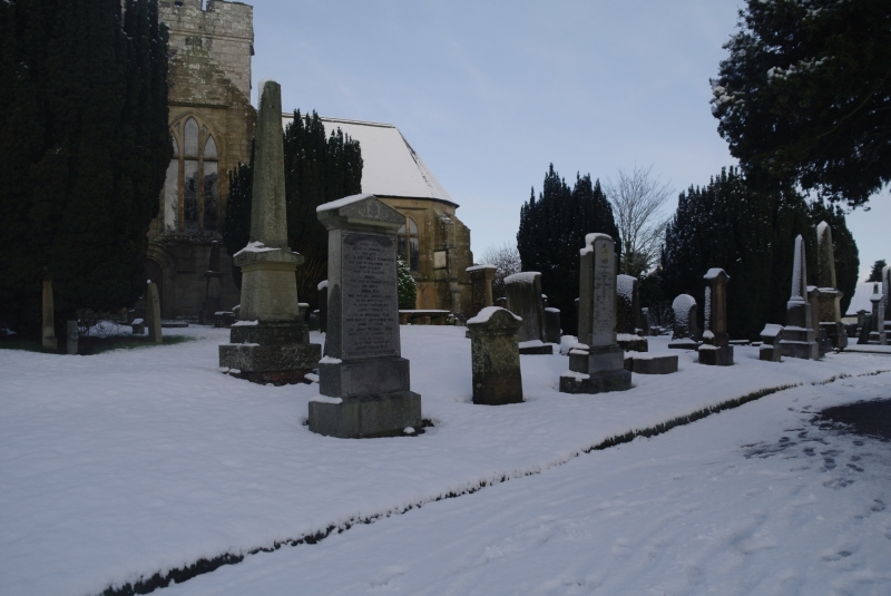
Entry Name: Churchyard, Biggar Church
Listing Name: St Mary's Church-Graveyard Kirkstyle
Listing Date: 12 January 1971
Category: B
Source: Historic Scotland
Source ID: 357808
Historic Scotland Designation Reference: LB22258
Building Class: Cultural
Also known as: Biggar Church, Churchyard
ID on this website: 200357808
Location: Biggar
County: South Lanarkshire
Town: Biggar
Electoral Ward: Clydesdale East
Traditional County: Lanarkshire
Tagged with: Churchyard
17th, 18th and 19th century table, and upright tombstones
and obelisks, some set into chancel wall. Wrought-iron gates
and railings.
External links are from the relevant listing authority and, where applicable, Wikidata. Wikidata IDs may be related buildings as well as this specific building. If you want to add or update a link, you will need to do so by editing the Wikidata entry.


Other nearby listed buildings
