Approximate Location Map
Large Map »
Latitude: 56.1557 / 56°9'20"N
Longitude: -3.9525 / 3°57'8"W
OS Eastings: 278821
OS Northings: 697608
OS Grid: NS788976
Mapcode National: GBR 1C.J00W
Mapcode Global: WH4P0.8J3T
Plus Code: 9C8R524X+72
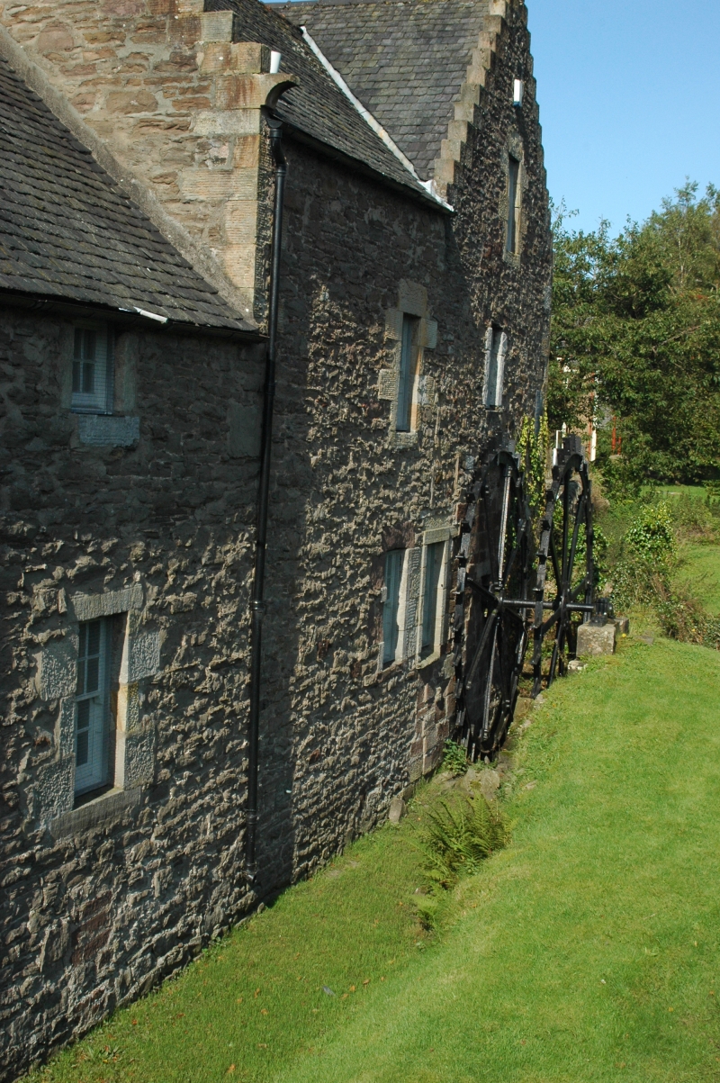
Entry Name: The Mill, Station Road, Bridge Of Allan
Listing Name: Station Road Old Mill Inverallan
Listing Date: 5 September 1973
Category: B
Source: Historic Scotland
Source ID: 358311
Historic Scotland Designation Reference: LB22698
Building Class: Cultural
Also known as: Bridge Of Allan, Station Road, The Mill
ID on this website: 200358311
Location: Bridge Of Allan
County: Stirling
Town: Bridge Of Allan
Electoral Ward: Dunblane and Bridge of Allan
Traditional County: Stirlingshire
Tagged with: Grain mill
1710. 2/3-storey rubble-built L-plan with crowsteps and finials, slated roof. Completely restored 1969, machinery then restored to working order, external undershot wheel. Machinery removed 1979 (LBC).
Now used as craft shop.
External links are from the relevant listing authority and, where applicable, Wikidata. Wikidata IDs may be related buildings as well as this specific building. If you want to add or update a link, you will need to do so by editing the Wikidata entry.


Other nearby listed buildings
