Approximate Location Map
Large Map »
Latitude: 55.6506 / 55°39'2"N
Longitude: -2.2547 / 2°15'16"W
OS Eastings: 384069
OS Northings: 639704
OS Grid: NT840397
Mapcode National: GBR D3P3.N7
Mapcode Global: WH9Z0.B7KH
Plus Code: 9C7VMP2W+64
Entry Name: 21 High Street, Coldstream
Listing Name: 21 High Street
Listing Date: 9 June 1971
Category: B
Source: Historic Scotland
Source ID: 358867
Historic Scotland Designation Reference: LB23058
Building Class: Cultural
Also known as: Coldstream, 21 High Street
ID on this website: 200358867
Location: Coldstream
County: Scottish Borders
Town: Coldstream
Electoral Ward: Mid Berwickshire
Traditional County: Berwickshire
Tagged with: House
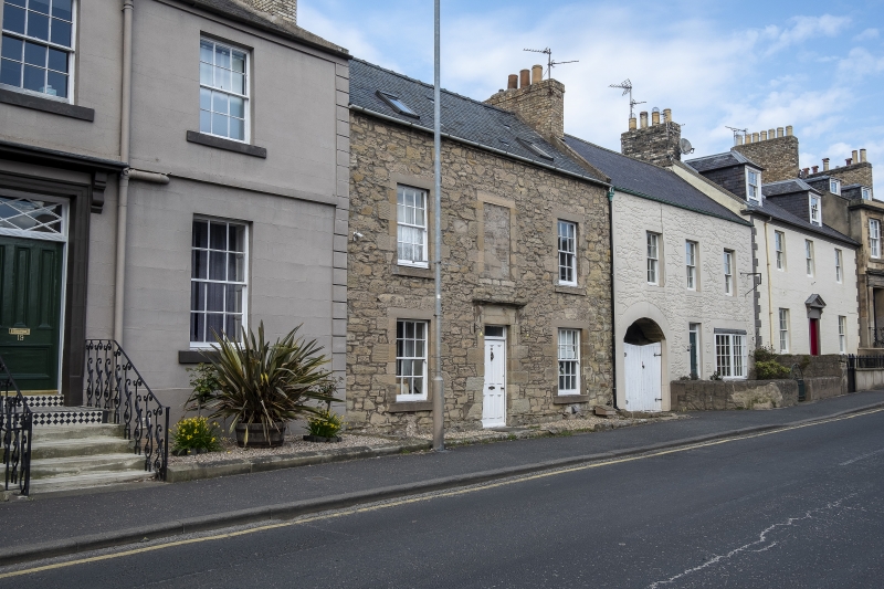
Earlier 19th century. 2-storey with attic, 3-bay, symmetrical house. Rubble with droved ashlar dressings. Cornice over panelled door. Mostly 12-pane sash windows except ground floor at right, 16-pane, and blind to upper centre. Slate roof. Brick end stacks.
External links are from the relevant listing authority and, where applicable, Wikidata. Wikidata IDs may be related buildings as well as this specific building. If you want to add or update a link, you will need to do so by editing the Wikidata entry.


Other nearby listed buildings
