Latitude: 56.2612 / 56°15'40"N
Longitude: -2.6252 / 2°37'30"W
OS Eastings: 361368
OS Northings: 707804
OS Grid: NO613078
Mapcode National: GBR 2Y.9J51
Mapcode Global: WH8TL.NW3H
Plus Code: 9C8V796F+FW
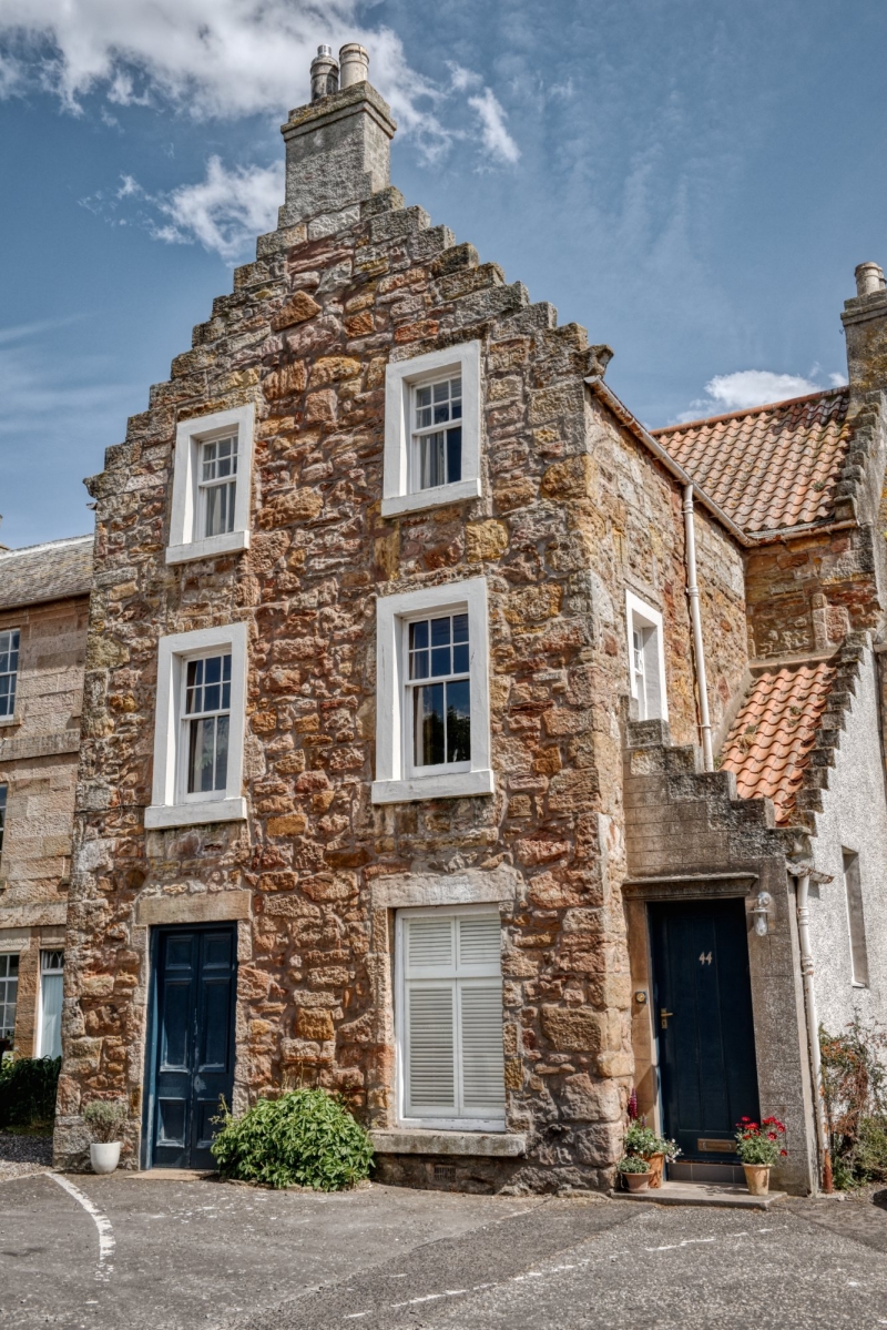
Entry Name: 42, 44 Marketgate, Crail
Listing Name: 42 and 44 Marketgate
Listing Date: 9 May 1972
Category: B
Source: Historic Scotland
Source ID: 359011
Historic Scotland Designation Reference: LB23277
Building Class: Cultural
Also known as: Crail, 42, 44 Marketgate
ID on this website: 200359011
Location: Crail
County: Fife
Town: Crail
Electoral Ward: East Neuk and Landward
Traditional County: Fife
Tagged with: Architectural structure
Early 18th century, lintels at back dated 1708 and 1710. 2-storey and attic rubble with margins, T-plan with 2-window crowstepped gable, forestair in W re-entrant angle, 1-window on W with swept dormer head; pantiled, slate skirting.
External links are from the relevant listing authority and, where applicable, Wikidata. Wikidata IDs may be related buildings as well as this specific building. If you want to add or update a link, you will need to do so by editing the Wikidata entry.


Other nearby listed buildings