Approximate Location Map
Large Map »
Latitude: 56.2602 / 56°15'36"N
Longitude: -2.6274 / 2°37'38"W
OS Eastings: 361228
OS Northings: 707700
OS Grid: NO612077
Mapcode National: GBR 2Y.9HNQ
Mapcode Global: WH8TL.MX17
Plus Code: 9C8V796F+32
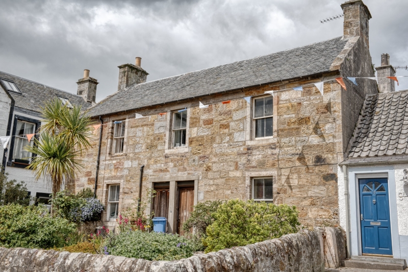
Entry Name: 17 High Street, Crail
Listing Name: 17 and 19 High Street
Listing Date: 9 May 1972
Category: B
Source: Historic Scotland
Source ID: 359048
Historic Scotland Designation Reference: LB23310
Building Class: Cultural
Also known as: Crail, 17 High Street
ID on this website: 200359048
Location: Crail
County: Fife
Town: Crail
Electoral Ward: East Neuk and Landward
Traditional County: Fife
Tagged with: Architectural structure
Circa 1840 wing at rear added 1870. 2-storey 3-window
stuccoed with margins, artisan Roman doric doorpiece,
pantiled with slate skirting.
External links are from the relevant listing authority and, where applicable, Wikidata. Wikidata IDs may be related buildings as well as this specific building. If you want to add or update a link, you will need to do so by editing the Wikidata entry.


Other nearby listed buildings
