Approximate Location Map
Large Map »
Latitude: 56.2599 / 56°15'35"N
Longitude: -2.6279 / 2°37'40"W
OS Eastings: 361200
OS Northings: 707665
OS Grid: NO612076
Mapcode National: GBR 2Y.9PJG
Mapcode Global: WH8TL.LXVG
Plus Code: 9C8V795C+XR
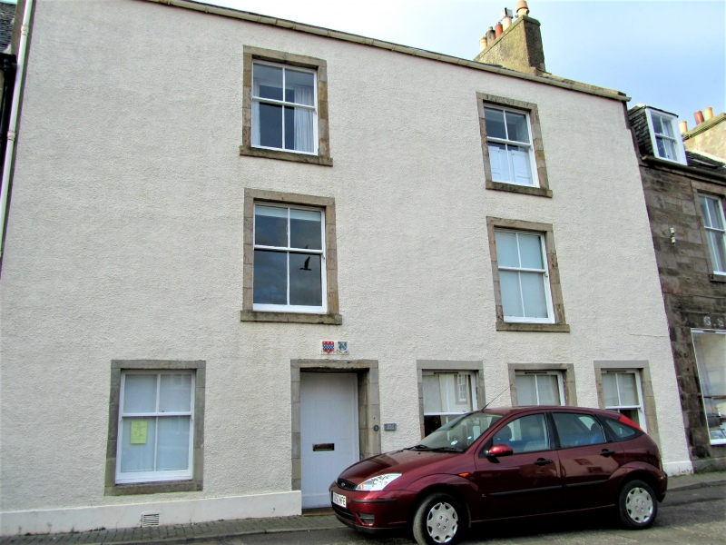
Entry Name: 31, 33 High Street, Crail
Listing Name: 31 & 33 High Street
Listing Date: 9 May 1972
Category: C
Source: Historic Scotland
Source ID: 359053
Historic Scotland Designation Reference: LB23315
Building Class: Cultural
ID on this website: 200359053
Location: Crail
County: Fife
Town: Crail
Electoral Ward: East Neuk and Landward
Traditional County: Fife
Tagged with: Architectural structure
Originally 1710 reconstructed early 19th century. 3 windows 2 doors alternately ground floor, 2 window above, stuccoed with painted margins, slated. Initials and crests of Lindsay and Leslie families, dated 17 HL 10.
Re-categorised as C(S) from B for Group (2006). The listing relates specifically to the group interest of the subject. It applies, as always, to interior as well as exterior, as appropriate to building type.
External links are from the relevant listing authority and, where applicable, Wikidata. Wikidata IDs may be related buildings as well as this specific building. If you want to add or update a link, you will need to do so by editing the Wikidata entry.


Other nearby listed buildings
