Approximate Location Map
Large Map »
Latitude: 56.0046 / 56°0'16"N
Longitude: -2.5151 / 2°30'54"W
OS Eastings: 367977
OS Northings: 679188
OS Grid: NT679791
Mapcode National: GBR ND4V.BJY
Mapcode Global: WH8W0.BBLP
Plus Code: 9C8V2F3M+RX
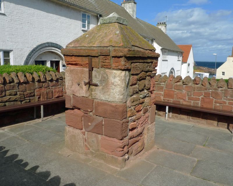
Entry Name: Well-Head, Victoria Street, Dunbar
Listing Name: Victoria Street Well-Head
Listing Date: 11 January 1988
Category: C
Source: Historic Scotland
Source ID: 360968
Historic Scotland Designation Reference: LB24863
Building Class: Cultural
ID on this website: 200360968
Location: Dunbar
County: East Lothian
Town: Dunbar
Electoral Ward: Dunbar and East Linton
Traditional County: East Lothian
Tagged with: Well
18th century. Squat pillar form with pyramidal top. Squared
red sandstone rubble. Iron pump handle (disconnected from
supply).
The well will have served Cat's Row, a legendary tenement
(demolished in 1933).
External links are from the relevant listing authority and, where applicable, Wikidata. Wikidata IDs may be related buildings as well as this specific building. If you want to add or update a link, you will need to do so by editing the Wikidata entry.


Other nearby listed buildings
