Approximate Location Map
Large Map »
Latitude: 55.0701 / 55°4'12"N
Longitude: -3.613 / 3°36'46"W
OS Eastings: 297099
OS Northings: 576257
OS Grid: NX970762
Mapcode National: GBR 396T.LB
Mapcode Global: WH5WJ.GTRK
Plus Code: 9C7R39CP+2R
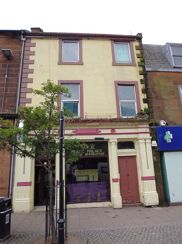
Entry Name: 17 Castle Street, Dumfries
Listing Name: 17 Castle Street
Listing Date: 6 March 1981
Category: B
Source: Historic Scotland
Source ID: 362609
Historic Scotland Designation Reference: LB26117
Building Class: Cultural
ID on this website: 200362609
Early 19th century, 3 storeys, 3 bays, later 19th century
"Thomsonesque" shop at ground with Ionic columns, coupled
outer pilasters and cornice with antefixae. Upper
floors painted droved ashlar, rusticated quoins and
margins; single windows, sashes, with 12-pane glazing
pattern; eaves/lintel band, cornice; straight skews;
slate roof.
External links are from the relevant listing authority and, where applicable, Wikidata. Wikidata IDs may be related buildings as well as this specific building. If you want to add or update a link, you will need to do so by editing the Wikidata entry.


Other nearby listed buildings
