Approximate Location Map
Large Map »
Latitude: 55.0681 / 55°4'5"N
Longitude: -3.6094 / 3°36'33"W
OS Eastings: 297320
OS Northings: 576033
OS Grid: NX973760
Mapcode National: GBR 397V.C0
Mapcode Global: WH5WJ.JWF2
Plus Code: 9C7R399R+66
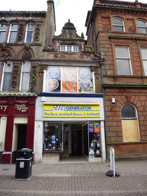
Entry Name: 14 English Street, Dumfries
Listing Name: 14 English Street
Listing Date: 6 March 1981
Category: C
Source: Historic Scotland
Source ID: 362699
Historic Scotland Designation Reference: LB26177
Building Class: Cultural
ID on this website: 200362699
Location: Dumfries
County: Dumfries and Galloway
Town: Dumfries
Electoral Ward: Nith
Traditional County: Dumfriesshire
Tagged with: Architectural structure
Late 19th century. Flemish; 2-storey and attic. Ornate
Dutch gable and flanking pilasters of first floor survive.
sandstone ashlar. Slate roof.
Listed for relationship with Queensberry hotel.
External links are from the relevant listing authority and, where applicable, Wikidata. Wikidata IDs may be related buildings as well as this specific building. If you want to add or update a link, you will need to do so by editing the Wikidata entry.


Other nearby listed buildings
