Approximate Location Map
Large Map »
Latitude: 55.9356 / 55°56'8"N
Longitude: -3.2314 / 3°13'53"W
OS Eastings: 323167
OS Northings: 672078
OS Grid: NT231720
Mapcode National: GBR 8DM.YR
Mapcode Global: WH6SS.B2GJ
Plus Code: 9C7RWQP9+6C
Entry Name: Caledonian Brewery, Slateford Road, Edinburgh
Listing Name: Slateford Road Caledonian Brewery
Listing Date: 9 January 1987
Category: B
Source: Historic Scotland
Source ID: 363690
Historic Scotland Designation Reference: LB26833
Building Class: Cultural
ID on this website: 200363690
Location: Edinburgh
County: Edinburgh
Town: Edinburgh
Electoral Ward: Sighthill/Gorgie
Traditional County: Midlothian
Tagged with: Brewery building
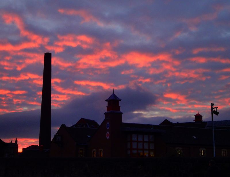
Components of various dates from later 19th to early 20th century. Very complete example of brewery complex of medium size; comprising offices, maltings with double kiln and double barley kiln, brewhouse, chimney and ancillary buildings. Main ranges in red brick with white brick dressings, partly whitewashed.
OFFICE BLOCK: single storey to road, 3-storey to rear; 3-bay elevation to road, faced with squared and stugged cream ashlar sandstone. Panelled door at centre with rectangular plate glass fanlight and gable; flanked by bipartite windwos, under projecting eaves. End elevations blank, gabled; also with projecting eaves.
MALTINGS: single storey and attic 7-bay front to road; bright red brick, cornice and parapet. At centre, architraved door and flanking narrow rectangular lights, semi-circular window in gable above. Flanking blind aracde with oculi above piers. 3-light corniced dormers flank gable behind parapet. Single bay end elevations with semi-circular window in gable. Forms bridge over service road below. Added to earlier mostly 4-storey, 8-bay malting range behind with kiln at N. Regular graduated fenestration; leading bays in 5th and 8th bays from left.
INTERIOR: cast-iron columns with wooden floors (some alterations including doubling width and strengthening).
BARLEY KILN: joined to malting kiln by 3-storey linking block.
BREWHOUSE RANGE: 4-storey, with 3-bay gable to railway; 2-storey 3-bay range links to 5-storey 2-bay water tower with gabled hip roof.
CHIMNEY: tall, circular sectioned, attached to boiler house.
ANCILLARY BUILDINGS: include single storey bottling and despatch stores to N of bowling green and altered stable range. Some equipment of interest survives including 3 coppers and a boiler. Office with timber sash and case plate glass windows, otherwise timber casement windows. Grey slate roofs; moulded brick skews.
BOUNDARY WALLS: dwarf rubble walls with ashlar coping and cast-iron railings front blocks to road; linked by full height rubble walls with semi-circular coping.
Founded, and earliest parts built, in 1868 for Lorimer and Clark. Site made use of the railway and specially sunk well. Coal is still used to fire the coppers.
External links are from the relevant listing authority and, where applicable, Wikidata. Wikidata IDs may be related buildings as well as this specific building. If you want to add or update a link, you will need to do so by editing the Wikidata entry.


Other nearby listed buildings
