Approximate Location Map
Large Map »
Latitude: 55.945 / 55°56'42"N
Longitude: -3.1853 / 3°11'7"W
OS Eastings: 326068
OS Northings: 673078
OS Grid: NT260730
Mapcode National: GBR 8QJ.8C
Mapcode Global: WH6SM.1TGT
Plus Code: 9C7RWRW7+2V
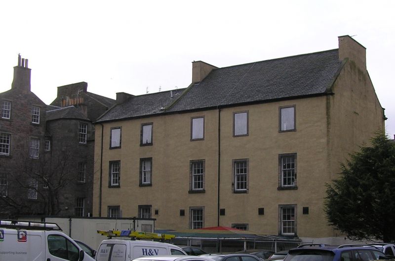
Entry Name: Chapel House, Chapel Street, Edinburgh
Listing Name: Chapel Street (Off) Chapel House (Archibald Bennet & Co)
Listing Date: 14 December 1970
Category: B
Source: Historic Scotland
Source ID: 366460
Historic Scotland Designation Reference: LB28500
Building Class: Cultural
Also known as: Edinburgh, Chapel Street, Chapel House
ID on this website: 200366460
Location: Edinburgh
County: Edinburgh
Town: Edinburgh
Electoral Ward: Southside/Newington
Traditional County: Midlothian
Tagged with: House
Mid 18th century: built by Robert Frame, mason. 3-storey
5-window squared rubble with margins, ashlar parapet with
podia bearing 6 urns.
External links are from the relevant listing authority and, where applicable, Wikidata. Wikidata IDs may be related buildings as well as this specific building. If you want to add or update a link, you will need to do so by editing the Wikidata entry.


Other nearby listed buildings
