Approximate Location Map
Large Map »
Latitude: 55.9445 / 55°56'40"N
Longitude: -3.1858 / 3°11'8"W
OS Eastings: 326034
OS Northings: 673019
OS Grid: NT260730
Mapcode National: GBR 8QJ.5K
Mapcode Global: WH6SM.1V67
Plus Code: 9C7RWRV7+RM
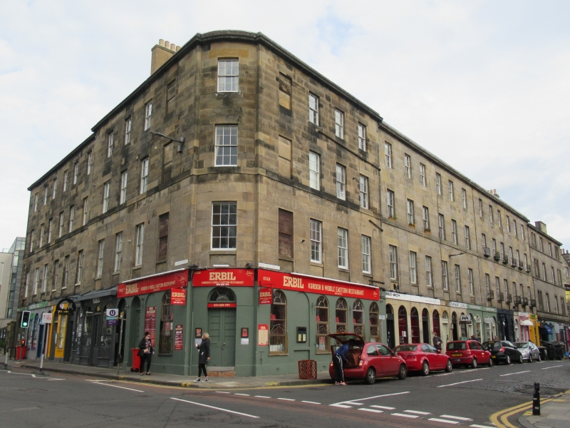
Entry Name: 55-57 West Nicolson Street, Edinburgh
Listing Name: Nicolson Street West, 55-57 and 14, 16 Chapel Street.
Listing Date: 12 December 1974
Category: B
Source: Historic Scotland
Source ID: 369324
Historic Scotland Designation Reference: LB29437
Building Class: Cultural
ID on this website: 200369324
Location: Edinburgh
County: Edinburgh
Town: Edinburgh
Electoral Ward: Southside/Newington
Traditional County: Midlothian
Tagged with: Architectural structure
Circa 1815. Corner block continuous with above but slightly
advanced. 4-storey ashlar, 4-window each front 1-window curved
corner, ground floor arched as shops.
External links are from the relevant listing authority and, where applicable, Wikidata. Wikidata IDs may be related buildings as well as this specific building. If you want to add or update a link, you will need to do so by editing the Wikidata entry.


Other nearby listed buildings
