Approximate Location Map
Large Map »
Latitude: 55.9588 / 55°57'31"N
Longitude: -3.2112 / 3°12'40"W
OS Eastings: 324477
OS Northings: 674640
OS Grid: NT244746
Mapcode National: GBR 8KC.1F
Mapcode Global: WH6SL.NH27
Plus Code: 9C7RXQ5Q+GG
Entry Name: 25 Raeburn Place, Edinburgh
Listing Name: 19-25 (Odd Numbers) Raeburn Place
Listing Date: 28 March 2000
Category: C
Source: Historic Scotland
Source ID: 369631
Historic Scotland Designation Reference: LB29580
Building Class: Cultural
ID on this website: 200369631
Location: Edinburgh
County: Edinburgh
Town: Edinburgh
Electoral Ward: Inverleith
Traditional County: Midlothian
Tagged with: Architectural structure
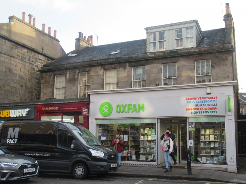
Probably James Milne, 1814; early 20th century single storey block to N. 2-storey and attic, 6-bay double villa, comprising 2 3-bay mirrored houses. Tooled coursed sandstone ashlar with polished dressings to principal elevation; sandstone rubble to remainder. Long and short quoins; eaves cornice; eaves blocking course.
N (PRINCIPAL) ELEVATION: near-symmetrical; ground floor obscured by single storey retail units, predominantly modern shopfronts; regular fenestration to 1st floor; 4-light rectangular dormer to right of attic floor,
modern and 2-pane skylights to centre and left of attic floor; stair leading to 1st floor entrance to left, gateway to right.
E AND W ELEVATIONS: gabled.
N ELEVATION: not seen 1999.
Predominantly 12-pane timber sash and case windows. Grey slate roof with lead ridge. Stone skews. Coped gablehead stacks with circular cans. Cast-iron rainwater goods.
INTERIOR: not seen 1999.
B-Group with 28, 28A, 30 and 30A-D Raeburn Place, 32, 34 and 34A Raeburn Place, 27, 27A-B and 29 Raeburn Place, 31, 31A and 33 Raeburn Place and 35-41 Raeburn Place (see separate listings). In 1780 Sir Henry Raeburn married Ann Edgar, widow of Count Leslie, who owned Old Deanhaugh House, which then became Raeburn's. Shortly afterwards he bought the nearby St Bernard House, and consequently owned much of the land to the N of the Water of Leith. In 1813 he commenced on developing and feuing some of this land, at that time known as Deanhaugh, for
housing. Raeburn Place was the first to be built, and by 1825 the work was all but finished. The E end of the street was originally a series of double villas, with gardens in front. The gardens were developed from the beginning of the 20th century into single storey retail units.
External links are from the relevant listing authority and, where applicable, Wikidata. Wikidata IDs may be related buildings as well as this specific building. If you want to add or update a link, you will need to do so by editing the Wikidata entry.


Other nearby listed buildings
