Latitude: 55.9491 / 55°56'56"N
Longitude: -3.2081 / 3°12'29"W
OS Eastings: 324649
OS Northings: 673558
OS Grid: NT246735
Mapcode National: GBR 8KG.NW
Mapcode Global: WH6SL.PQHP
Plus Code: 9C7RWQXR+MP
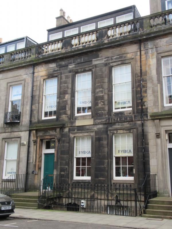
Entry Name: 24 Rutland Street, Edinburgh
Listing Name: 22-26 (Even Nos) Rutland Street, Including Railings and Lamp Standards
Listing Date: 14 December 1970
Category: B
Source: Historic Scotland
Source ID: 370008
Historic Scotland Designation Reference: LB29694
Building Class: Cultural
Also known as: Edinburgh, 24 Rutland Street
ID on this website: 200370008
Location: Edinburgh
County: Edinburgh
Electoral Ward: City Centre
Traditional County: Midlothian
Tagged with: Architectural structure
External links are from the relevant listing authority and, where applicable, Wikidata. Wikidata IDs may be related buildings as well as this specific building. If you want to add or update a link, you will need to do so by editing the Wikidata entry.


Other nearby listed buildings